- Usage in publication:
-
- Camp Grafton Formation
- Modifications:
-
- Named
- Dominant lithology:
-
- Sand
- Gravel
- Silt
- AAPG geologic province:
-
- Williston basin
Summary:
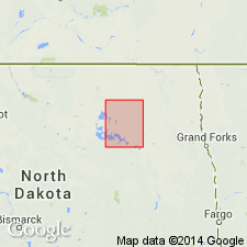
Named as a formation (1 of 5) in Coleharbor Group; named for the National Guard training camp near Devils Lake, Ramsey Co, ND, Williston basin. No type locality designated. Occurs in a valley in Ramsey Co, but extends laterally several miles on either side of the valley; where it occurs in the valley, ranges from 100-200 ft thick; where it spills onto the plain as a fluvial deposit, is 30-50 ft thick. Consists of clean, well-sorted sand and gravel with thin silt and clay layers. Lignite and shale vary in abundance in the very coarse sand of the formation. Upper member consists of silt with some sand and gravel locally. This upper member is widespread in southern Ramsey Co and extends northward into Towner Co and southward into eastern Benson Co, all in ND; ranges from 4-109 ft thick in area north of Devils Lake chain; in buried valleys, ranges from 14-350+ ft thick. Overlies Cando Formation of Coleharbor Group; underlies Churchs Ferry (new) of Coleharbor Group. Geologic maps. Cross section. Of Pleistocene age.
Source: GNU records (USGS DDS-6; Denver GNULEX).
For more information, please contact Nancy Stamm, Geologic Names Committee Secretary.
Asterisk (*) indicates published by U.S. Geological Survey authors.
"No current usage" (†) implies that a name has been abandoned or has fallen into disuse. Former usage and, if known, replacement name given in parentheses ( ).
Slash (/) indicates name conflicts with nomenclatural guidelines (CSN, 1933; ACSN, 1961, 1970; NACSN, 1983, 2005, 2021). May be explained within brackets ([ ]).

