

- Usage in publication:
-
- Camp Davis conglomerate
- Modifications:
-
- First used
- Dominant lithology:
-
- Conglomerate
- Limestone
- AAPG geologic province:
-
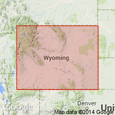
- Green River basin
Summary:
First published use as a name applied to a 5000+/-ft thick conglomerate and agglomerate unconformably? above a Miocene basic breccia and unconformably below Pleistocene till. The conglomerate and agglomerate were locally derived. Thin fresh water limestone beds, too. Fossil horse tooth of late Miocene or early Pliocene age identified. Differs from Pass Peak conglomerate as to source area. Pass Peak was derived largely from local Mesozoic and Paleozoic rocks. [Name was first used in an abstract by Eardley, 1942.] Stratigraphic chart. Footnote to chart says that the Camp Davis "flanks the Hoback Range" which lies south of the Gros Ventre Range in the Greater Green River basin.
Source: GNU records (USGS DDS-6; Denver GNULEX).
- Usage in publication:
-
- Camp Davis formation*
- Modifications:
-
- Named
- Dominant lithology:
-
- Conglomerate
- Claystone
- Limestone
- Tuff
- AAPG geologic province:
-
- Yellowstone province
Summary:
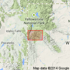
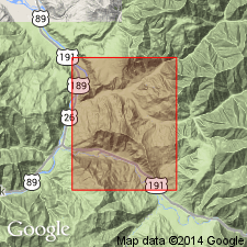
First used by Eardley (1944) on a privately printed map. Brief descriptions published by several authors 1949-1955. [This paper has first comprehensive description.] Named for Camp Davis, University of Michigan camp, along Hoback River. Type section along east side U.S. Hwy 187, sec 29, T39N, R115W, Teton Co, WY, Yellowstone province. Type abundantly fossiliferous but only basal 450 ft exposed. Thickest most complete section on north side of Horse Creek between sec 13, T39N, R116W northeast to secs 7 and 8, T39N, R115W where is 5,600 ft thick. Present along Snake and Hoback Rivers; may be present southwest of Gros Ventre Mountains. Some high-level gravels in Gros Ventre have been assigned to Camp Davis. At type, lower 250 ft are light-gray, hard, cliff-forming conglomerate (chiefly Paleozoic limestone and dolomite clasts, some pre-Cambrian clasts in gray sandy limestone matrix). Overlying white, gray, pink heterogeneous sequence of limestone, claystone, tuff, pumicite, conglomerate and diatomite 200 ft thick succeeded by: 1) poorly exposed chocolate-colored claystone, one white tuff, interbedded, poorly consolidated conglomerate (derived from Tensleep sandstone, Madison limestone); 2) 4,000 ft red conglomerate (derived from Triassic, Paleozoic and few from pre-Cambrian rocks; coarsest at top). Pliohippus tooth-early Pliocene age. Also has mollusks, ostracodes, diatomite. Younger than Colter formation; older than Teewinot formation.
Source: GNU records (USGS DDS-6; Denver GNULEX).
- Usage in publication:
-
- Camp Davis Formation*
- Modifications:
-
- Age modified
- AAPG geologic province:
-
- Yellowstone province
Summary:
Age changed from early Pliocene to late Miocene on basis of placement of the Miocene-Pliocene boundary at 5 m.y. Also has mollusks, pollen, and sparse vertebrate fossils of early late Miocene age. Area reported on is in the Yellowstone province.
Source: GNU records (USGS DDS-6; Denver GNULEX).
- Usage in publication:
-
- Camp Davis Formation*
- Modifications:
-
- Geochronologic dating
- AAPG geologic province:
-
- Yellowstone province
Summary:
Fission-track ages on zircon reported from lower part of type section in Teton Co, WY, Yellowstone province, of 5.0-9.2 Ma.
Source: GNU records (USGS DDS-6; Denver GNULEX).
For more information, please contact Nancy Stamm, Geologic Names Committee Secretary.
Asterisk (*) indicates published by U.S. Geological Survey authors.
"No current usage" (†) implies that a name has been abandoned or has fallen into disuse. Former usage and, if known, replacement name given in parentheses ( ).
Slash (/) indicates name conflicts with nomenclatural guidelines (CSN, 1933; ACSN, 1961, 1970; NACSN, 1983, 2005, 2021). May be explained within brackets ([ ]).