The National Geologic Map Database is migrating to a new infrastructure. We apologize for any service disruptions during this process.
|
|---|


- Usage in publication:
-
- Camels Butte Member
- Modifications:
-
- Named
- Dominant lithology:
-
- Claystone
- Siltstone
- Lignite
- Sandstone
- AAPG geologic province:
-
- Williston basin
Summary:
Camels Butte Member of Golden Valley Formation. Name proposed for rocks formerly called the "upper member" of the Golden Valley Formation. Is 25.4 m thick at type section. Composed of (ascending): (1) a lower 47 m thick micaceous siltstone, claystone, and lignite with the distinctive fossil fern SALVINIA and diffusion-banded limonite; some of the lignites may be as much as 1.8 m thick, but are of local extent; (2) a middle 7.9 m thick parallel-bedded micaceous sandstone; and (3) an upper 12.8 m thick cross-bedded micaceous sandstone with a prominent lens of conglomerate. Blocky tan chert beds 7.6 to 30+ cm thick are common. Large mica flakes (1 to 2 mm across) are prominent throughout. Most of the heavy minerals and rock fragments indicate a metamorphic and silicic volcanic source. Camels Butte deposited in a low fluvial region. Deep cutting by some channels during Camels Butte time suggests start of uplift. The channel lithofacies is a cross-bedded, calcite-cemented, fine- to medium-grained sandstone. The lower contact with the newly named Bear Den Member of Golden Valley is sharp. The Camels Butte is a soft, yellow to tan, montmorillonitic claystone, whereas the Bear Den is a hard, dark-gray, kaolinitic claystone. Unconformably underlies White River Group. Age is Eocene (Graybull). Fossils (vertebrate, invertebrate, and plants) indicative of the early Wasatchian listed. Report also includes measured sections, cross sections, correlation chart.
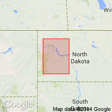
Type section: on Camels Butte, 14.5 km north of Dickenson, in SE/4 SE/4 sec. 27, T. 141 N., R. 96 W., southern Dunn Co., ND (Williston basin).
Source: Modified from GNU records (USGS DDS-6; Denver GNULEX).
For more information, please contact Nancy Stamm, Geologic Names Committee Secretary.
Asterisk (*) indicates published by U.S. Geological Survey authors.
"No current usage" (†) implies that a name has been abandoned or has fallen into disuse. Former usage and, if known, replacement name given in parentheses ( ).
Slash (/) indicates name conflicts with nomenclatural guidelines (CSN, 1933; ACSN, 1961, 1970; NACSN, 1983, 2005, 2021). May be explained within brackets ([ ]).