- Usage in publication:
-
- Camelback Granite
- Modifications:
-
- Named
- Dominant lithology:
-
- Granite
- AAPG geologic province:
-
- Basin-and-Range province
Summary:
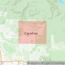
Named for Camelback Mountain. Type locality on Camelback Mountain in Phoenix, Paradise Valley quad, northern Maricopa Co., central AZ. First described by Pewe and others, 1986. Presented under two headings: "Igneous-Intrusive" and "In Situ Weathered". "Igneous-Intrusive" type extends from Papago Park pediment in southeastern Phoenix to Superstition volcanic field east of Apache Junction to Tonto Foothills northeast of Carefree basin. Consists of yellowish tan to pale pink to reddish-brown, massive, spheroidally weathered, coarse-grained granite with large, twinned potassium-feldspar crystals up to 4 in. long; locally contains xenoliths of meta-argillite and fine-grained, highly resistant aplite dikes up to 16 feet thick, which form near-vertical cliffs and peaks, such as Pinnacle Peak 5 mi southeast of study area. Dikes probably same composition as granite. Field observation reveals granite/meta-argillite contact of Black Mountain is intrusive rather than fault related, as previously mapped (Sumner and Boyer, 1973; Wagner, 1979; Manera, 1982; Dames and Moore, 1989). Based on this field evidence Camelback Mountain Granite and Middle Proterozoic (1400 Ma) Go John Diorite (new) are thought to intrude Precambrian meta-argillite--phyllite complex. "In Situ Weathered" type explained by field traverses and well-log analyses that show, below Miocene basalt and tuff, a shallow to deeply weathered zone of tan, moderately sorted, unbedded, unconsolidated granite in silty matrix (termed veneer) up to 40 feet thick. Only surface exposure of this decomposed granite is 140 feet thick and underlies Miocene lower basalt at Big Brownies Hill in southeastern corner of Carefree basin; is also penetrated in five wells (119, 122, 156, 159, and 164) where thickness varies from 110 feet to >485 feet; maximum of 500 feet in east-central Carefree basin. Absolute age at type and within study area unknown but plutons near junction of Beeline Highway and Shea Boulevard similarly characterized by large potassium-feldspar crystals yield sphene fission-track ages averaging 1400 Ma (Stuckless and Naeser, 1972). Inferred age is Middle Proterozoic. Report includes geologic map and cross section, and stratigraphic nomenclature table.
Source: GNU records (USGS DDS-6; Denver GNULEX).
For more information, please contact Nancy Stamm, Geologic Names Committee Secretary.
Asterisk (*) indicates published by U.S. Geological Survey authors.
"No current usage" (†) implies that a name has been abandoned or has fallen into disuse. Former usage and, if known, replacement name given in parentheses ( ).
Slash (/) indicates name conflicts with nomenclatural guidelines (CSN, 1933; ACSN, 1961, 1970; NACSN, 1983, 2005, 2021). May be explained within brackets ([ ]).

