The National Geologic Map Database is migrating to a new infrastructure. We apologize for any service disruptions during this process.
|
|---|


- Usage in publication:
-
- Camelback formation
- Modifications:
-
- original reference
- Dominant lithology:
-
- Conglomerate
- Sandstone
- AAPG geologic province:
-
- Basin-and-Range province
Summary:
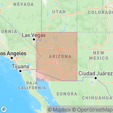
Pg. 32-33. Camelback Formation. Occurs on west end of Camelback Mountain in Phoenix region, Maricopa County, south-central Arizona. Series of red arkosic conglomerates and sandstones. Consists of three members on Camelback Mountain (ascending): dark-maroon arkose, lying unconformably on older granite, about 100 feet thick; middle member of lighter color, composed of coarser material, with great angular boulders, about 200 to 300 feet thick; and dark-red arkose, in part conglomeratic, with sand matrix, well-defined bedding and ripple marks, at least 200 feet thick. Age is Tertiary(?).
Source: US geologic names lexicon (USGS Bull. 1200, p. 590-591).
For more information, please contact Nancy Stamm, Geologic Names Committee Secretary.
Asterisk (*) indicates published by U.S. Geological Survey authors.
"No current usage" (†) implies that a name has been abandoned or has fallen into disuse. Former usage and, if known, replacement name given in parentheses ( ).
Slash (/) indicates name conflicts with nomenclatural guidelines (CSN, 1933; ACSN, 1961, 1970; NACSN, 1983, 2005, 2021). May be explained within brackets ([ ]).