The National Geologic Map Database is migrating to a new infrastructure. We apologize for any service disruptions during this process.
|
|---|


- Usage in publication:
-
- Cambria Felsite
- Modifications:
-
- Named
- Dominant lithology:
-
- Tuff
- AAPG geologic province:
-
- California Coast Ranges province
Summary:
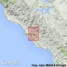
Type locality designated as an area within 17 square km between San Simeon and Santa Rosa Creeks in secs.11,12,13,14 23, and 24, T27S R8E, Cambria quad, San Luis Obispo Co, CA. Good exposures occur in northwest corner of sec. 11, at Scott Rock in sec.23, and along CA Hwy 41 east of Coast Union High School in sec.24. Shown on geologic map of Cambria area. Composed of hard, rhyolite-dacite crystalline felsite; soft, white, poorly exposed tuff, locally characterized by dark bentonitic soil; and, locally, a reworked soft tuff unit. Is 115 m thick. Unconformably underlies Lospe, Vaqueros, Sandholdt, or Pismo Formations. Age is Oligocene.
Source: GNU records (USGS DDS-6; Menlo GNULEX).
- Usage in publication:
-
- Cambria Felsite*
- Modifications:
-
- Mapped
- Reference
- Adopted
- AAPG geologic province:
-
- California Coast Ranges province
Summary:
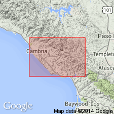
Type section designated as exposures near Cambria at Scott Rock, approximately 4000 ft northwest of Coast Union High School, sec.23 T27S R8E, Cambria quad, San Luis Obispo Co, CA. Reference section designated as exposures along Santa Rosa Creek (California State Hwy 41), approximately 4000 ft east of Coast Union High School, and west-central part of sec.34 T27S R10E, Cypress Mountain quad, San Luis Obispo Co, CA. Shown on geologic map of Cambria region.
Source: GNU records (USGS DDS-6; Menlo GNULEX).
For more information, please contact Nancy Stamm, Geologic Names Committee Secretary.
Asterisk (*) indicates published by U.S. Geological Survey authors.
"No current usage" (†) implies that a name has been abandoned or has fallen into disuse. Former usage and, if known, replacement name given in parentheses ( ).
Slash (/) indicates name conflicts with nomenclatural guidelines (CSN, 1933; ACSN, 1961, 1970; NACSN, 1983, 2005, 2021). May be explained within brackets ([ ]).