The National Geologic Map Database is migrating to a new infrastructure. We apologize for any service disruptions during this process.
|
|---|


- Usage in publication:
-
- Cambalache Formation*
- Modifications:
-
- Named
- Dominant lithology:
-
- Breccia
- Andesite
- Sandstone
- Mudstone
- AAPG geologic province:
-
- Caribbean region
Summary:
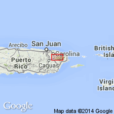
The Cambalache Formation, here named, consists of andesitic volcanic breccia, sandstone, and mudstone characterized by altered pumice and perlite. Includes the Toma de Agua Vitrophyre Member, 0 to 50 m thick, at the top of the formation. Vitrophyre is black, vitreous, with columnar jointing. Conformably overlies the Hato Puerco Formation; sharply and conformably underlies the Canovanas Formation. Thickness averages 350 to 450 m, up to 600 m. Age is Late Cretaceous (Turonian) based on fossils.
Source: GNU records (USGS DDS-6; Reston GNULEX).

- Usage in publication:
-
- Cambalache Formation*
- Modifications:
-
- Overview
- AAPG geologic province:
-
- Caribbean region
Summary:
The Cambalache Formation occurs in eastern Puerto Rico and consists of pumiceous volcanic breccia, sandstone, mudstone, and locally, welded ash-flow tuff. Maximum thickness is 600 meters but is typically 350 to 450 meters. The Cambalache is of Late Cretaceous age.
Source: GNU records (USGS DDS-6; Reston GNULEX).
For more information, please contact Nancy Stamm, Geologic Names Committee Secretary.
Asterisk (*) indicates published by U.S. Geological Survey authors.
"No current usage" (†) implies that a name has been abandoned or has fallen into disuse. Former usage and, if known, replacement name given in parentheses ( ).
Slash (/) indicates name conflicts with nomenclatural guidelines (CSN, 1933; ACSN, 1961, 1970; NACSN, 1983, 2005, 2021). May be explained within brackets ([ ]).