The National Geologic Map Database is migrating to a new infrastructure. We apologize for any service disruptions during this process.
|
|---|


- Usage in publication:
-
- Calvin sandstone*
- Modifications:
-
- First used
- Dominant lithology:
-
- Sandstone
- Shale
- AAPG geologic province:
-
- Arkoma basin
- Chautauqua platform
Summary:
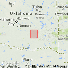
First published use of name; intent to name not stated, and no type locality designated. Origin of name not stated. Area of report is Coalgate quad, Coal and Hughes Cos, OK in Arkoma basin and Chautauqua platform where unit is exposed in north-central and western parts of quad. Composed of massive and thin-bedded sandstone with some shaly beds in upper part, 140-240 ft thick. For nearly 140 ft upward from base, is massive but not very hard sandstone. In northern part of occurrence this lower and more massive member of the formation crops out in the steep hillsides and bluffs overlooking the more level underlying Senora formation (new) to east. Grades into overlying Wetumka shale (new). In southern part of outcrop, lower sandy member becomes shaly, and even the massive beds which occur are more friable than same deposits in northern part of quad. Near middle of lower sandstone member, west of Sand Creek, there is a shaly and slightly calcareous bed which contains hematite; bright-red color of this bed upon weathering is a characteristic feature of unit. Upper part of unit is least shaly in northern part of area, and many beds are hard and weather into slabs and hard plates. Upper 90-100 ft here contains two, and in places more, shaly beds 10-20 ft thick. Sandstone beds of this upper portion decrease southwestward from 40 ft to thin layers interstratified with shales. Carboniferous age. Geologic map, columnar section.
Source: GNU records (USGS DDS-6; Denver GNULEX).
For more information, please contact Nancy Stamm, Geologic Names Committee Secretary.
Asterisk (*) indicates published by U.S. Geological Survey authors.
"No current usage" (†) implies that a name has been abandoned or has fallen into disuse. Former usage and, if known, replacement name given in parentheses ( ).
Slash (/) indicates name conflicts with nomenclatural guidelines (CSN, 1933; ACSN, 1961, 1970; NACSN, 1983, 2005, 2021). May be explained within brackets ([ ]).