

- Usage in publication:
-
- Calvert formation
- Modifications:
-
- Named
- AAPG geologic province:
-
- Atlantic Coast basin
Shattuck, G.B., 1902, The Miocene problem of Maryland [abs.]: Science, new series, v. 15, p. 906.
Summary:
Divided Chesapeake Group into 3 formations; in ascending order, Calvert, Choptank, and St. Mary's formations. Formations have clearly defined faunas. No lithologic description in this paper.
Source: GNU records (USGS DDS-6; Reston GNULEX).
- Usage in publication:
-
- Calvert formation
- Modifications:
-
- Revised
- Dominant lithology:
-
- Sand
- Clay
- Marl
- AAPG geologic province:
-
- Atlantic Coast basin
Summary:
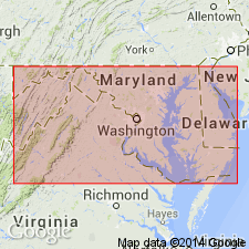
Named for Calvert County because of its typical development there. An almost unbroken exposure rises nearly 100 ft and extends from Chesapeake Bay to Drum Point, a distance of about 30 mi. Is found on both sides of the Bay (Kent, Queen Anne's, Talbot, and Caroline Cos. on Eastern Shore and Anne Arundel, Prince George's, Charles, Calvert, and St. Mary's Cos., on Western Shore. Occurs mainly as cliffs along large or in walls of stream gorges. Subdivided on Western Shore into Fairhaven diatomaceous earth (base) and Plum Point marls (remainder of formation). The Fairhaven ranges in color from brown to white to greenish and consists of mostly diatoms in very fine quartz matrix; calcareous material present only at base of member. Also contains casts of Miocene fossils and organic remains of reworked Eocene fossils. Is divided into 3 zones [based on color?]. The overlying Plum Point marls consist of bluish-green to grayish-brown and buff sandy clays and marls containing organic remains and diatoms. Is divided into 12 zones [based on color and fossil content?]. Thickness of Calvert is unknown although well record at Crisfield in Somerset Co. indicates thickness of 310 ft. Underlies either Choptank formation or heavy mantle of gravels of either Lafayette or Columbia formations; overlies Eocene deposit. Age is Miocene. Report contains long list of fossils too numerous to mention here.
Source: GNU records (USGS DDS-6; Reston GNULEX).
- Usage in publication:
-
- Calvert formation*
- Modifications:
-
- Areal extent
- AAPG geologic province:
-
- Atlantic Coast basin
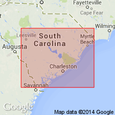
Summary:
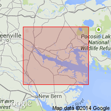
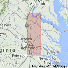
Extended to VA. Is only formation of Chesapeake group present in Richmond area. Underlies plateau at Richmond and to the north, east, and southeast of the city. Most extensive exposure is on steep slopes of Shockoe Creek valley from Franklin Street north and west up to the main valley and its branches. Overlies Aquia formation, with contacts visible along west side of Shockoe Valley from Seventh to Broad Streets. Top of Aquia is somewhat eroded and material from Aquia is mixed with basal Calvert. Underlies Lafayette formation, with contacts seen in gravel pits on the north slope of Bacons Quarter Branch valley and in shafts descending to old Church Hill tunnel. Report includes long list of diatoms and rhizopods.
Source: GNU records (USGS DDS-6; Reston GNULEX).
- Usage in publication:
-
- Calvert formation*
- Modifications:
-
- Age modified
- AAPG geologic province:
-
- Atlantic Coast basin
Summary:
Chart showing Oligocene and Miocene formations shows Calvert as being middle Miocene with a footnote that, according to T.W. Vaughan, the Calvert and other formations once thought by him to be Tortonian (upper Miocene) are now considered Helvetian (middle Miocene); this returns to the opinions of Dall (1904). The Calvert does not contain ORTHAULAX.
Source: GNU records (USGS DDS-6; Reston GNULEX).
- Usage in publication:
-
- Calvert formation*
- Modifications:
-
- Areal extent
- AAPG geologic province:
-
- Atlantic Coast basin
Summary:
Tentatively extended from VA into NC.
Source: GNU records (USGS DDS-6; Reston GNULEX).
- Usage in publication:
-
- Calvert Formation
- Modifications:
-
- Areal extent
- AAPG geologic province:
-
- Atlantic Coast basin
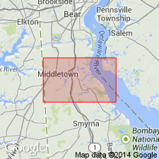
Summary:
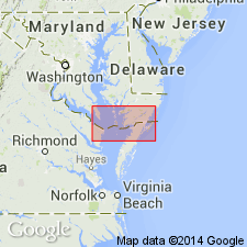
Extended from MD into northern DE.
Source: GNU records (USGS DDS-6; Reston GNULEX).
- Usage in publication:
-
- Calvert Formation*
- Modifications:
-
- Revised
- AAPG geologic province:
-
- Atlantic Coast basin
Summary:
Name of Fairhaven Diatomaceous Earth Member changed to Fairhaven Member.
Source: GNU records (USGS DDS-6; Reston GNULEX).
- Usage in publication:
-
- Calvert Formation*
- Modifications:
-
- Areal extent
- Revised
- AAPG geologic province:
-
- Atlantic Coast basin
Summary:
Calvert Formation geographically restricted from NC and southeasternmost VA and is replaced by Pungo River Formation. In northeastern MD and central DE, Alloway Clay Member reassigned from Calvert Formation of Chesapeake Group to Kirkwood Formation, here geographically extended from NJ and PA into northeastern MD and central DE. An older cycle of sand and diatomaceous clay beds, termed the Dunkirk beds, underlies Popes Creek Sand Member (first use, see Gibson, 1983a, for formal naming) along Patuxent River and is lowermost of Calvert strata.
Source: GNU records (USGS DDS-6; Reston GNULEX).
- Usage in publication:
-
- Calvert Formation*
- Modifications:
-
- Revised
- AAPG geologic province:
-
- Atlantic Coast basin
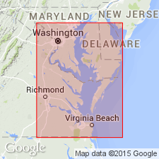
Summary:
Advance copy (1978). Calvert Formation. Recognized in southern Delaware, southern Maryland, and most of eastern Virginia (see figs. 2, 3). Divided into (ascending): Popes Creek Sand Member (new, early Miocene) in Maryland; Fairhaven Member (early Miocene) in Maryland and Virginia; and Plum Point Marl Member (early and middle Miocene) in Maryland. Is equivalent to Pungo River Formation of southeastern Virginia and eastern North Carolina, and to Kirkwood Formation of central and northern Delaware and southern New Jersey. [Age is early to middle Miocene, based on ages of its members.]
Source: Modified from GNU records (USGS DDS-6; Reston GNULEX).

- Usage in publication:
-
- Calvert Formation*
- Modifications:
-
- Age modified
- Biostratigraphic dating
- AAPG geologic province:
-
- Atlantic Coast basin
Summary:
Advance copy (1978). Calvert Formation. Age changed from middle Miocene --to-- early and middle Miocene. [Age of Fairhaven Member is early Miocene; age of Plum Point Marl Member is early and middle Miocene.] Beds (zones) 10 through 12 of Shattuck (1904) contain diagnostic planktonic foram assemblages. Bed 10 yielded GLOBIGERINA PRAEBULLOIDES PSEUDOCIPEROENSIS Blow, GLOBIGERINOIDES ALTIAPERTURUS Bolli, G. SICANUS de Stefani, and PRAEORBULINA GLOMEROSA GLOMEROSA (Blow), all of which correspond to planktonic foram upper zone N8 to lower zone N9. Beds 11 and 12 yielded PRAEORBULINA GLOMEROSA CIRCULARIS and ORBULINA SUTURALIS, indicating correspondence with lower zone N9. [This manuscript was reviewed by GNU in June, 1978.]
Source: Modified from GNU records (USGS DDS-6; Reston GNULEX).
- Usage in publication:
-
- Calvert Formation*
- Modifications:
-
- Revised
- AAPG geologic province:
-
- Atlantic Coast basin
Summary:
Calvert Beach Member is revised from lowest member of Choptank Formation to uppermost member of underlying Calvert Formation. Based on correction of miscorrelation of lithically similar beds in upper part of Calvert Formation and lower part of Choptank Formation. The Calvert Beach Member, according to Gernant (1970), corresponds to Zone 16 of Shattuck (1904), which is at the base of the Choptank. The Plum Point Marl Member of underlying Calvert Formation corresponds to Shattuck's Zones 4-15. As revised here, the Calvert Beach corresponds to Zones 14-16 and the Plum Point corresponds to Zones 4-13.
Source: GNU records (USGS DDS-6; Reston GNULEX).
- Usage in publication:
-
- Calvert Formation*
- Modifications:
-
- Revised
- AAPG geologic province:
-
- Atlantic Coast basin
Summary:
Data from the section in the Haynesville coreholes, 0.65 mi northwest of Haynesville, (lat 37 deg 57'13"N, long 76 deg 60'26"W), Richmond Co., VA. The lower shelly sand beds of the Calvert Formation are equivalent to the upper Fairhaven Member or the lower Plum Point Marl Member in MD. Overlying the shelly sand beds are 7 phosphatic diatomaceous fining-upward sequences. The lower two are named the informal Plum Point marl beds, equivalent to the Plum Point Marl Member in MD. The upper five sequences are named the informal Calvert Beach beds, equivalent to the Calvert Beach Member in MD.
Source: GNU records (USGS DDS-6; Reston GNULEX).
- Usage in publication:
-
- Calvert Formation*
- Modifications:
-
- Revised
- AAPG geologic province:
-
- Atlantic Coast basin
Summary:
Name Popes Creek Sand Member for bed at the base of Calvert Formation is discarded, and these strata are reassigned to the Fairhaven Member. Though a phosphate pebble lag indicates an unconformity, diatomaceous clays on either side of that contact are so similar that they cannot be separated lithologically.
Source: GNU records (USGS DDS-6; Reston GNULEX).
- Usage in publication:
-
- Calvert Formation
- Modifications:
-
- Age modified
- Biostratigraphic dating
- AAPG geologic province:
-
- Atlantic Coast basin
Summary:
Oldest part of the Calvert Formation in the Dover test well is of late Oligocene age (27 or 28 Ma) according to Benson and others (1985: DE G.S. Bull. 17). Therefore, age ranges from late Oligocene to middle Miocene based on pollen grains. Palynoflora of the Calvert of DE is similar to that of the Kirkwood Formation of NJ. Depositional environment of the Calvert ranges from marginal marine to outer neritic and all sporomorphs were therefore transported to the site by streams and winds. Plant microfossils of the Calvert indicate a climate similar to that occurring at present in the Coastal Plain of GA or FL.
Source: GNU records (USGS DDS-6; Reston GNULEX).

- Usage in publication:
-
- Calvert Formation
- Modifications:
-
- Overview
- AAPG geologic province:
-
- Atlantic Coast basin
Summary:
Chesapeake Group undivided on the State map. However, its formations--Chowan River, Yorktown, Eastover, St. Marys, Choptank, and Calvert--are discussed in the text. Calvert commonly consists of 2 to 7 fining-upward sequences. Each sequence includes a light- to dark-olive gray basal sand, very fine to fine, clayey and silty, very sparsely to abundantly shelly. Grades upward to sandy, diatomaceous clay-silt and diatomite. Members not discussed. Typical mollusks include CHESAPECTEN COCCYMELUS, CRASSATELLA MELINUS, and ECPHORA TRICOSTATA. Thickness ranges from 0 to 600 ft. Age is early and middle Miocene.
Source: Modified from GNU records (USGS DDS-6; Reston GNULEX).
- Usage in publication:
-
- Calvert Formation
- Modifications:
-
- Biostratigraphic dating
- AAPG geologic province:
-
- Atlantic Coast basin
Summary:
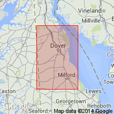
Road construction south of Smyrna, DE, exposed two shell beds of the Calvert Formation. The lower shell bed has yielded one of the best collections of early Miocene fossil vertebrate remains in eastern North America. It has also produced 130 species of mollusks, many of which are newly discovered. Siliceous microfossils occurring in a silt interval between the upper and lower shell beds provide age information on the Calvert, including radiolarians from the early Miocene time interval between 19.2 and 17.4 m.y. ago. Also found was the index diatom ACTINOPTYCHUS HELIOPELTA which has been estimated to be no younger than about 17.8 or 17.9 m.y., but possibly as old as 22 or 23 m.y. The fact that it occurs at or above the highest occurrence of radiolarian identifying the S. WOLFFII zone indicates that the diatom may be as young or younger than 17.4 m.y. Therefore, the narrowest age range assignable to the fossil site near Smyrna is from 19.2 to 17.4 m.y.
Source: GNU records (USGS DDS-6; Reston GNULEX).
For more information, please contact Nancy Stamm, Geologic Names Committee Secretary.
Asterisk (*) indicates published by U.S. Geological Survey authors.
"No current usage" (†) implies that a name has been abandoned or has fallen into disuse. Former usage and, if known, replacement name given in parentheses ( ).
Slash (/) indicates name conflicts with nomenclatural guidelines (CSN, 1933; ACSN, 1961, 1970; NACSN, 1983, 2005, 2021). May be explained within brackets ([ ]).