

- Usage in publication:
-
- Calvert Beach Member
- Modifications:
-
- Named
- Dominant lithology:
-
- Sand
- AAPG geologic province:
-
- Atlantic Coast basin
Summary:
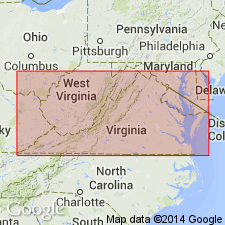
Named as a member of Choptank Formation. Named for Calvert Beach, west side of Chesapeake Bay, Calvert Co., southern MD. Occurs in southern MD and VA. Consists of green to blue, muddy, fine-grained sand. Thickness ranges from 3.6 to 4.8 m. Overlies Calvert Formation; gradationally underlies Drumcliff Member of Choptank Formation. Age is middle Miocene.
Source: GNU records (USGS DDS-6; Reston GNULEX).
- Usage in publication:
-
- Calvert Beach Member*
- Modifications:
-
- Revised
- AAPG geologic province:
-
- Atlantic Coast basin
Summary:
Calvert Beach Member is revised from lowest member of Choptank Formation to uppermost member of underlying Calvert Formation. Based on correction of miscorrelation of lithologically similar beds in upper part of Calvert Formation and lower part of Choptank Formation. The Calvert Beach Member, according to Gernant (1970), corresponds to Zone 16 of Shattuck (1904), which is at the base of the Choptank. The Plum Point Marl Member of underlying Calvert Formation corresponds to Shattuck's Zones 4-15. As revised here, the Calvert Beach corresponds to Zones 14-16 and the Plum Point corresponds to Zones 4-13.
Source: GNU records (USGS DDS-6; Reston GNULEX).
- Usage in publication:
-
- Calvert Beach beds*
- Modifications:
-
- Revised
- AAPG geologic province:
-
- Atlantic Coast basin
Summary:
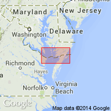
Data from the section in the Haynesville coreholes, 0.65 mi northwest of Haynesville, (lat 37 deg 57'13"N, long 76 deg 60'26"W), Richmond Co., VA. The lower shelly sand beds of the Calvert Formation are equivalent to the upper Fairhaven Member or the lower Plum Point Marl Member in MD. Overlying the shelly sand beds are 7 phosphatic diatomaceous fining-upward sequences. The lower two are named the informal Plum Point marl beds, equivalent to the Plum Point Marl Member in MD. The upper five sequences are named the informal Calvert Beach beds, equivalent to the Calvert Beach Member in MD.
Source: GNU records (USGS DDS-6; Reston GNULEX).
For more information, please contact Nancy Stamm, Geologic Names Committee Secretary.
Asterisk (*) indicates published by U.S. Geological Survey authors.
"No current usage" (†) implies that a name has been abandoned or has fallen into disuse. Former usage and, if known, replacement name given in parentheses ( ).
Slash (/) indicates name conflicts with nomenclatural guidelines (CSN, 1933; ACSN, 1961, 1970; NACSN, 1983, 2005, 2021). May be explained within brackets ([ ]).