- Usage in publication:
-
- Callville limestone*
- Modifications:
-
- Original reference
- Dominant lithology:
-
- Limestone
- AAPG geologic province:
-
- Great Basin province
Summary:
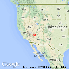
Pg. 47; 1928, USGS Bull. 798. Callville limestone. Dark-colored limestone, with zones of lighter gray at intervals; many layers almost black; hard and dense, coarse granular texture subordinate; beds regular and massive; occasional thin layers; shaly layers rare; chert less abundant than in the Mississippian limestones. Thickness 1,100+ feet [2,000+/- feet]. Fossils are Pennsylvanian (Magdalena), according to G.H. Girty. Top not defined because not known. Is unconformably overlain by Supai formation. Name is applied to all Pennsylvanian limestones in Callville Mountain, Muddy Mountains, Clark County, southeastern Nevada, but all sections there are incomplete. Overlies Bluepoint limestone, probably unconformably.
Source: US geologic names lexicon (USGS Bull. 896, p. 319-320).
- Usage in publication:
-
- Callville limestone
- Modifications:
-
- Revised
- AAPG geologic province:
-
- Plateau sedimentary province
- Great Basin province
Summary:
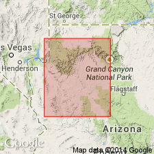
Restricted to Pennsylvanian limestone beds beneath the Permian dolomitic limestone beds. The Permian beds formerly part of the Callville are renamed Pakoon limestone in this report. The lower contact is with the Mississippian Rogers Spring limestone in the western exposures and with the Redwall limestone in the eastern exposures. Divisible into a lower and upper member in the Virgin Mountains. To east it tongues into redbeds of the Supai formation. A lower tongue of the upper member is recognized in the Chino Valley where it overlies and underlies Supai. Cross sections. Measured sections. Is 690 ft thick on Pakoon Ridge, 430+ ft thick on North Grand Wash Cliffs, 277+ ft thick in the Hurricane Cliffs. As revised, Callville has a lower member of gray, thick-bedded, cliff-forming, commonly oolitic, fine-grained limestone that is thought to wedge out under the Shivwits Plateau and an upper member of gray, fine-grained, silty, locally cross-bedded, slope-forming limestone that extends east of Chino Valley. A Virgilian fusulinid found 106 ft below top of Callville. Assigned a Virgilian age. Report area is in the Plateau sedimentary and Great Basin provinces.
Source: GNU records (USGS DDS-6; Denver GNULEX).
- Usage in publication:
-
- Callville Limestone
- Modifications:
-
- Areal extent
- AAPG geologic province:
-
- Great Basin province
Summary:
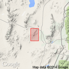
Name extended to the Star Range, Beaver Co, UT in the Great Basin province. Mapped (geologic map) on the west side of the range. Overlies Redwall Limestone. Underlies Talisman Quartzite. Contrasts with overlying and underlying formations. Callville is reddish brown; Redwall is dark gray; and Talisman is dark brown. Is about 1937 ft thick. Consists in report area of gray to brown sandstone with thin lenses of gray limestone in lower part, and of dark-gray dolomite in upper part. Fossils--brachiopods, crinoid fragments, fish teeth, fusulinids. Is of "early Medial Pennsylvanian" age. Stratigraphic figure. Name preferred to prior use of Topache Limestone by Butler (1913).
Source: GNU records (USGS DDS-6; Denver GNULEX).
- Usage in publication:
-
- Callville Limestone*
- Modifications:
-
- Age modified
- Revised
- AAPG geologic province:
-
- Great Basin province
Summary:
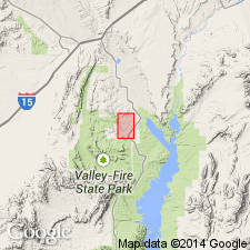
Callville Limestone in Muddy Mountains and Frenchman Mountain (where it is about 1500 ft thick) may range in age from Late Mississippian through Pennsylvanian to Early Permian on the basis of fossils [fusulinids, brachiopods] identified by L.G. Henbest and MacKenzie Gordon, Jr. Bluepoint Limestone is included in the basal part of the Callville Limestone.
Source: GNU records (USGS DDS-6; Menlo GNULEX).
- Usage in publication:
-
- Callville Limestone*
- Modifications:
-
- Biostratigraphic dating
- AAPG geologic province:
-
- Great Basin province
Summary:
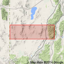
Presence of conodont faunas--HINDEODUS MINUTUS, ADETOGNATHUS SPATHUS, "SPATHGNATHODUS"--date Callville Limestone as Morrowan or Early Pennsylvanian age. Unconformably overlies Redwall Limestone. Unconformably underlies Pakoon Dolomite. The hiatus between the Callville and Pakoon thought to represent most of Pennsylvanian time. Distribution of Callville in west UT shown on map. Conodonts found in two sections--one at Black Mountain and another at Bradshaw Mountain, Beaver Co, UT in the Great Basin province--listed. Consists of ledge-forming wackestone and packstone. Corals common. Oncolites also abundant. Conodonts present at both localities indicate very shallow water nearshore environment. The localities are on the Callville shelf which is considered to be an extension of the cratonic shelf of northeast UT. Is a transgressive marine deposit.
Source: GNU records (USGS DDS-6; Denver GNULEX).
For more information, please contact Nancy Stamm, Geologic Names Committee Secretary.
Asterisk (*) indicates published by U.S. Geological Survey authors.
"No current usage" (†) implies that a name has been abandoned or has fallen into disuse. Former usage and, if known, replacement name given in parentheses ( ).
Slash (/) indicates name conflicts with nomenclatural guidelines (CSN, 1933; ACSN, 1961, 1970; NACSN, 1983, 2005, 2021). May be explained within brackets ([ ]).

