- Usage in publication:
-
- Calls Fort shale member
- Modifications:
-
- Named
- Dominant lithology:
-
- Limestone
- Shale
- AAPG geologic province:
-
- Great Basin province
- Wasatch uplift
Summary:
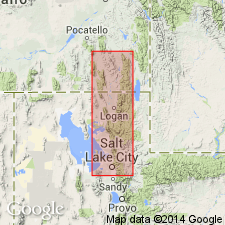
Is the first published paper to use Calls Fort shale member as a member of Bloomington formation. Original designation as a member is attributed to Denson, 1942, Ph. D. Thesis. A section was measured from east of Calls Fort monument in SE1/4 sec 14, T10N, R2W, to second spur to north on north side of Precipice Canyon, Box Elder Co., UT on the Wasatch uplift. Is recognized in the Bear River Range on the Wasatch uplift and in the Wasatch Range in the Great Basin province. Consists of 200 ft of gray, calcareous shale and gray limestone in the Calls Fort section. Overlies and underlies an unnamed part of the Bloomington formation. Is of Middle Cambrian age.
Source: GNU records (USGS DDS-6; Denver GNULEX).
For more information, please contact Nancy Stamm, Geologic Names Committee Secretary.
Asterisk (*) indicates published by U.S. Geological Survey authors.
"No current usage" (†) implies that a name has been abandoned or has fallen into disuse. Former usage and, if known, replacement name given in parentheses ( ).
Slash (/) indicates name conflicts with nomenclatural guidelines (CSN, 1933; ACSN, 1961, 1970; NACSN, 1983, 2005, 2021). May be explained within brackets ([ ]).

