The National Geologic Map Database is migrating to a new infrastructure. We apologize for any service disruptions during this process.
|
|---|


- Usage in publication:
-
- Calliham sand
- Modifications:
-
- Original reference
- Dominant lithology:
-
- Sandstone
- AAPG geologic province:
-
- Gulf Coast basin
Summary:
Pg. 1302, 1315, etc. Calliham sand. Gray fossiliferous sand. Sam Houston, who suggested the name for this sand and who has traced it from Frio River to Karnes County line, found it varies from highly fossiliferous, fine-grained gray sand, as in outcrops on Frio River, to rice-grained and conglomeratic sand cropping out in Atascosa County south of Campbellton. Thickness 20+/- feet; absent, both on surface and in wells, in western Karnes County. Is a zone in Whitsett formation as here defined, underlying Fashing clays and overlying Dubose sands and clays. Age is late Eocene.
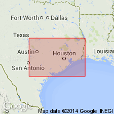
Typically exposed on Frio River north of Calliham, where Whitsett-Calliham Road crosses river, southern TX. Recognized in Atascosa and Karnes Cos., southern TX.
Source: US geologic names lexicon (USGS Bull. 896, p. 319).
- Usage in publication:
-
- Calliham sandstone member*
- Modifications:
-
- Principal reference
- Revised
- Adopted
- AAPG geologic province:
-
- Gulf Coast basin
Summary:
Pg. 2624 (fig. 1), 2626 (table 1), p. 2633. Termed Calliham sandstone member of Whitsett formation. At type locality, about 22 feet of medium-grained irregularly cross-bedded sandstone is exposed in south bank of river; upper 10 feet shows concretionary induration; about 2 feet from top is fossiliferous lens containing CORBULA-type pelecypods. Elsewhere sand is coarse-grained and conglomeratic; southwest of Fashing, consists of two layers of fossiliferous very fine-grained sandstone separated by 10 feet or more of silty clay; in gently sloping area around Fashing, becomes indistinguishable from Dabose member below and Fashing clay member above.
Type locality: about 0.6 mi north-northeast of village of Calliham where old Whitsett-Calliham Road crosses Frio River. Named from village of Calliham, which is near Frio River in McMullen Co. about 1 mi west of Live Oak Co. line on Farm Road 63 from Three Rivers to Tilden, southern TX.
Source: US geologic names lexicon (USGS Bull. 1200, p. 584).
- Usage in publication:
-
- Calliham Sandstone Member*
- Modifications:
-
- Revised
- Areal extent
- AAPG geologic province:
-
- Gulf Coast basin
Summary:
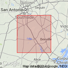
Calliham Sandstone Member of Whitsett Formation of Jackson Group. Calliham Sandstone Member, the stratigraphic equivalent of the Tordilla Sandstone Member (not new) of the Whitsett, restricted. Recognized east of Conquista Creek in Atascosa and McMullen Counties, south-central Texas. Overlies Dubose Member; underlies Fashing Clay Member [both of Whitsett]. Age is late Eocene. (Definition adopted by the USGS and Texas Geol. Survey.)
Source: Changes in stratigraphic nomenclature, 1972 (USGS Bull. 1394-A, p. A8-A9).

- Usage in publication:
-
- Calliham Sandstone Member
- Modifications:
-
- Areal extent
- AAPG geologic province:
-
- Gulf Coast basin
Summary:
Calliham Sandstone Member of Whitsett Formation of Jackson Group. Sand and tuff, thin-bedded, fossiliferous. Thickness about 20 feet. Lies above Dubose Clay Member and below Fashing Clay Member (both of Whitsett). Age is Eocene.
Not separately mapped. [Present in McMullen, Live Oak, Atascosa, and Karnes Cos., southern TX.]
Source: Publication.
- Usage in publication:
-
- Calliham Sandstone Member*
- Modifications:
-
- Areal extent
- Age modified
- AAPG geologic province:
-
- Gulf Coast basin
Summary:
Calliham Sandstone Member of Whitsett Formation. Eargle, 1972 (AAPG Bull., v. 56, no. 3) considered Calliham a time-equivalent of Tordilla Sandstone Member. He applied term Calliham to the medium- to coarse-grained sandstones in distributary channels, in Atascosa and McMullen Counties, Texas, and term Tordilla to the fine-grained beach sandstones in western Karnes County, Texas. New exposures in Karnes County (due to uranium mining) show that the Calliham channels scoured into the Tordilla beach sand, and though they are deposited physically at about the same horizon, the Calliham deposits are younger. The Calliham is equivalent in age to the Fashing Clay Member, which overlies the Tordilla. Age is late Eocene.
Source: Modified from GNU records (USGS DDS-6; Denver GNULEX).
For more information, please contact Nancy Stamm, Geologic Names Committee Secretary.
Asterisk (*) indicates published by U.S. Geological Survey authors.
"No current usage" (†) implies that a name has been abandoned or has fallen into disuse. Former usage and, if known, replacement name given in parentheses ( ).
Slash (/) indicates name conflicts with nomenclatural guidelines (CSN, 1933; ACSN, 1961, 1970; NACSN, 1983, 2005, 2021). May be explained within brackets ([ ]).