The National Geologic Map Database is migrating to a new infrastructure. We apologize for any service disruptions during this process.
|
|---|


- Usage in publication:
-
- "Caliente" formation
- Modifications:
-
- Original reference
- Biostratigraphic dating
- Dominant lithology:
-
- Conglomerate
- Sand
- Clay
- AAPG geologic province:
-
- Coastal basins
Summary:
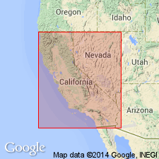
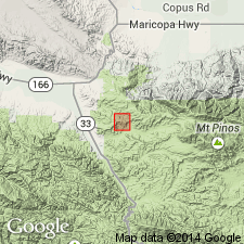
(T.W. Dibblee, Jr., p. 84.) Tentatively named "Caliente" formation. Coarse gray conglomerate, gray sands, and red clays; continental. Underlies "Apache" formation (new). Age is probably middle Miocene based on vertebrate fauna [listed] collected in Apache Canyon, in sec. 2, T. 8 N., R. 23 W., Mt. Pinos 15-min quadrangle, Ventura County, southern California.
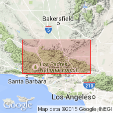
Type locality: Caliente Range, in Midway Peak SW and Elkhorn Hills quadrangles [scale 1:31,680], San Luis Obispo Co., southern CA.
Source: Publication; US geologic names lexicon (USGS Bull. 1200, p. 582-583); GNU records (USGS DDS-6; Menlo GNULEX).
- Usage in publication:
-
- Caliente red beds
- Modifications:
-
- Areal extent
- AAPG geologic province:
-
- Ventura basin
Summary:
Pg. 35, 36 (fig. 7), 37. Caliente red beds. Described in connection with gypsum deposits in Ventura County as Caliente red beds. [Age is early and middle Miocene.]
Source: US geologic names lexicon (USGS Bull. 1200, p. 582-583).
- Usage in publication:
-
- Caliente formation
- Modifications:
-
- Areal extent
- AAPG geologic province:
-
- Coastal basins
- Santa Maria basin
Schwade, I.T., 1954, Geology of Cuyama Valley and adjacent ranges, San Luis Obispo, Santa Barbara, Kern, and Ventura Counties [California]: California Division of Mines Bulletin, no. 170, Map Sheet 1., Prepared 1952
Summary:
Map Sheet 1. Caliente formation. Noted as occurring on eastern margin of Cuyama Valley where it overlies lower Miocene marine beds [Painted Rock formation] and in southeastern part of the valley in proximity to upper(?) Miocene nonmarine strata. [Age is lower and middle Miocene.]
Source: US geologic names lexicon (USGS Bull. 1200, p. 582-583).
- Usage in publication:
-
- Caliente formation*
- Modifications:
-
- Principal reference
- Biostratigraphic dating
- AAPG geologic province:
-
- Coastal basins
- Santa Maria basin
- Ventura basin
Summary:
Pg. 2974 (fig. 1), 2978 (fig. 3), 2993-2995. Caliente formation. On northeast flank of southeastern Caliente Range, Branch Canyon sandstone (new) and upper part of Painted Rock sandstone member of Vaqueros grade laterally eastward into continental redbeds; these continental beds of middle and lower Miocene are here designated Caliente formation. At type locality, consists predominantly of claystone, sandstone, and conglomerate, with some basalt flows; thickness about 4,200 feet; lower 1,000 feet grades abruptly westward into Painted Rock sandstone; overlying 1,100 feet grades laterally northwest into Branch Canyon sandstone; underlies Quatal formation (new) with accordant contact. In northern Cuyama Badlands, is about 3,000 feet thick; rests on Vaqueros formation or on Simmler redbeds. Formation is made up of brilliantly varicolored red and green claystone, arkosic sandstone, and incoherent conglomerates of terrestial deposition; they form the picturesque badland topography. West of Cuyama River, beds apparently grade westward into Branch Canyon and Vaqueros formations, although relationships are obscured by structural complexities; here the redbeds were mapped by English (1916) as Pato red member of Vaqueros formation. Age of vertebrate fauna (Dougherty, 1940; Savage, 1957) is determined to be Saucesian, Relizian, and probably Luisian Stages of Miocene.
Type locality: Caliente Range, in Midway Peak SW and Elkhorn Hills quadrangles (scale 1:31,680).
[According to GNU records (USGS DDS-6; Menlo GNULEX) type locality is in secs. 23 and 26, T. 11 N., R. 26 W., 5 to 6 mi northeast of New Cuyama, Elkhorn Hills and Wells Ranch 7.5-min quadrangles, San Luis Obispo Co., southern CA.]
Source: US geologic names lexicon (USGS Bull. 1200, p. 582-583); supplemental information from GNU records (USGS DDS-6; Menlo GNULEX).
- Usage in publication:
-
- Caliente Formation*
- Modifications:
-
- Adopted
- Age modified
- Biostratigraphic dating
- AAPG geologic province:
-
- Coastal basins
- Santa Maria basin
- Ventura basin
Summary:
Caliente Formation, as used by Hill and others (1958), is adopted by the USGS. In Santa Barbara Canyon, southeast of Cuyama Valley, includes the red beds assigned to it by Hill and others, 1958 (previously called †Pato Red Member [herein abandoned] of Vaqueros Formation by English, 1916). Overlies or intertongues with Vaqueros Formation and Branch Canyon Sandstone (new); conformably underlies Quatal Formation. Caliente has yielded vertebrate remains of following ages of North American land mammal chronology [NALMA]: Arikareean (late Oligocene? and early Miocene), Hemingfordian (middle Miocene), Barstovian (middle? and late Miocene), Clarendonian (late Miocene?) and Hemphillian (Pliocene). Caliente is therefore assigned Oligocene(?), Miocene, and Pliocene age, although it is mostly Miocene.
Type locality: in secs. 23 and 26, T. 11 N., R. 26 W., 5 to 6 mi northeast of New Cuyama [Elkhorn Hills and Wells Ranch 7.5-min quadrangles, San Luis Obispo Co., southern CA].
Source: Changes in stratigraphic nomenclature, 1973 (USGS Bull. 1395-A, p. A8-A9); supplemental information from GNU records (USGS DDS-6; Menlo GNULEX).
- Usage in publication:
-
- Caliente Formation*
- Modifications:
-
- Age modified
- AAPG geologic province:
-
- Coastal basins
- Santa Maria basin
- Ventura basin
Summary:
Age of Caliente Formation is Miocene as shown in fig. 2, p. 77, where Caliente occurs in Caliente Range, Cuyama Badlands, and Lockwood Valley. K-Ar ages of underlying Plush Ranch Formation of Carman (1964) in Lockwood Valley are 19.6 +/-1.1 and 17.4 +/-3.7 Ma.
Source: GNU records (USGS DDS-6; Menlo GNULEX).
For more information, please contact Nancy Stamm, Geologic Names Committee Secretary.
Asterisk (*) indicates published by U.S. Geological Survey authors.
"No current usage" (†) implies that a name has been abandoned or has fallen into disuse. Former usage and, if known, replacement name given in parentheses ( ).
Slash (/) indicates name conflicts with nomenclatural guidelines (CSN, 1933; ACSN, 1961, 1970; NACSN, 1983, 2005, 2021). May be explained within brackets ([ ]).