The National Geologic Map Database is migrating to a new infrastructure. We apologize for any service disruptions during this process.
|
|---|


- Usage in publication:
-
- Calhoun sandstone and shale
- Modifications:
-
- Original reference
- AAPG geologic province:
-
- Forest City basin
Summary:
Pg. 29. Calhoun sandstone and shale. Soft argillaceous sandstone, 12 to 20 feet thick, overlain by 38 to 45 feet of fine-textured bluish shale. Included in Upper Coal Measures of Shawnee County, northeastern Kansas. Overlies Calhoun limestone [Deer Creek] and underlies Topeka limestone.
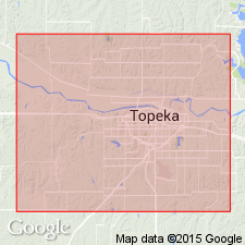
Named from exposures in Calhoun Bluffs, about 3 mi northeast of Topeka, Shawnee Co., eastern KS.
Source: US geologic names lexicon (USGS Bull. 896, p. 317).

- Usage in publication:
-
- Calhoun shale member
- Modifications:
-
- Overview
Summary:
Adopted by the USGS as a member of Shawnee formation in Missouri, underlying Topeka limestone member and overlying Deer Creek (†Calhoun) limestone member. In Kansas the Shawnee is treated as a group and the Calhoun shale as a formation.
In 1927 (Nebraska Geol. Survey Bull., 2nd ser., no. 1) G.E. Condra divided Calhoun shale into (descending) Iowa Point shale, Sheldon limestone, and Jones Point shale. In Oct. 1932 (revised classification chart of Kansas and Nebraska) R.C. Moore and G.E. Condra restricted Calhoun shale to the beds previously called Iowa Point shale, and included their Sheldon limestone and Jones Point shale in Deer Creek limestone. In 1935 (Nebraska Geol. Survey Paper, no. 8, p. 11) Condra reverted to his 1927 definition of Calhoun shale, as did R.C. Moore, 1936 (Kansas Geol. Survey Bull., no. 22).
See also "Modern classifications of the Pennsylvanian rocks of eastern Kansas and southeastern Nebraska," compiled by M.G. Wilmarth, Secretary of Committee on Geologic Names, USGS unpub. corr. chart, Oct. 1936, 2 sheets.
Source: US geologic names lexicon (USGS Bull. 896, p. 317).
- Usage in publication:
-
- Calhoun shale
- Modifications:
-
- Revised
- AAPG geologic province:
-
- Forest City basin
Summary:
Calhoun shale. Restricted this shale as explained in 1937 entry under Topeka limestone.
Source: US geologic names lexicon (USGS Bull. 896, p. 317).
- Usage in publication:
-
- Calhoun shale
- Modifications:
-
- Overview
Summary:
Pg. 22. Calhoun shale. Formation is 2 to 3 feet thick in Weeping Water Valley; about 10 feet at Kansas line. Overlies Deer Creek formation; underlies Hartford limestone (Wolf River) member of Topeka formation. Age is Late Pennsylvanian (Virgilian).
Source: US geologic names lexicon (USGS Bull. 1200, p. 580).

- Usage in publication:
-
- Calhoun formation
- Modifications:
-
- Revised
Summary:
Pg. 18. Calhoun formation of Shawnee group. Calhoun formation is a succession of shale beds which separates Deer Creek formation from overlying Topeka formation. Jones Point shale, Sheldon limestone, and Iowa Point shale members, previously included in the Calhoun, have been found to lie above rather than below the Hartford ("Wolf River") limestone and are included in Topeka formation. Age is Late Pennsylvanian (Virgilian).
Source: US geologic names lexicon (USGS Bull. 1200, p. 580).

- Usage in publication:
-
- Calhoun shale
- Modifications:
-
- Revised
Summary:
Pg. 65. Calhoun shale of Shawnee group. Clayey and sandy shale with minor amount of limestone and one or more coal beds. In northern Kansas a thin coal bed and much sandstone, a part of which fills channels, occur near top of formation. Dark-gray silty fossiliferous shale comprises lower part, and plant remains occur in sandy part. In southern Kansas, shale diminishes in thickness and is locally absent near Oklahoma line. Maximum thickness about 45 feet, near Kansas River. Overlies Deer Creek formation; underlies Topeka limestone. Age is Late Pennsylvanian (Virgilian).
Source: US geologic names lexicon (USGS Bull. 1200, p. 580-581).

- Usage in publication:
-
- Calhoun shale
- Modifications:
-
- Areal extent
Summary:
Pg. 17, fig. 5. Calhoun shale of Shawnee group. Dark-gray to bluish-green shale; fossiliferous. Thickness 1.5 to about 3 feet. Overlies Ervine Creek limestone member of Deer Creek limestone; underlies Hartford limestone member of Topeka limestone. Age is Late Pennsylvanian (Virgilian).
Source: US geologic names lexicon (USGS Bull. 1200, p. 581).

- Usage in publication:
-
- Calhoun Shale
- Modifications:
-
- Overview
- AAPG geologic province:
-
- Forest City basin
Summary:
(Paleozoic Era; Pennsylvanian System by J.M Jewett, H.G. O'Connor, and D.E. Zeller, p. 38.) Calhoun Shale of Shawnee Group. Recognized in Kansas. Clayey and sandy shale with minor amount of limestone and one or more coal beds. In northeastern Kansas, there is a thin coal bed near the top. Much sandstone occurs in the middle part of the formation. Locally sandstone lies on an erosional surface cut into the Ervine Creek Limestone. Dark-gray, silty, fossiliferous shale and locally flaggy limestone beds are present in the lower part. Plant remains occur in the sandy part. In southeastern Kansas, the shale thins progressively, and near the Oklahoma boundary it is very thin or absent. In northeastern Kansas, near the Nebraska line, the Calhoun is only about 7 feet thick. The maximum thickness of this formation is about 50 feet in Shawnee County, Kansas. Age is Late Pennsylvanian (Virgilian).
Source: Publication.
- Usage in publication:
-
- Calhoun Shale
- Modifications:
-
- Overview
- AAPG geologic province:
-
- Forest City basin
Summary:
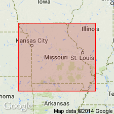
Pg. 123 (fig. 36), 125. Calhoun Shale of Shawnee Group. Except for a few beds of thin, argillaceous limestone near its base, is composed of light- to medium-gray, silty shale. Is absent, or not differentiated in many places in the subsurface north and west of its outcrop area in southern Holt and Nodaway Counties, northwestern Missouri. Exposures range from less than 5 feet to a maximum of 10 feet. Occurs above Ervine Creek Limestone Member of Deer Creek Formation and below Hartford Limestone Member of Topeka Formation, both of Shawnee Group. Age is Late Pennsylvanian (Virgilian).
Source: Publication.
For more information, please contact Nancy Stamm, Geologic Names Committee Secretary.
Asterisk (*) indicates published by U.S. Geological Survey authors.
"No current usage" (†) implies that a name has been abandoned or has fallen into disuse. Former usage and, if known, replacement name given in parentheses ( ).
Slash (/) indicates name conflicts with nomenclatural guidelines (CSN, 1933; ACSN, 1961, 1970; NACSN, 1983, 2005, 2021). May be explained within brackets ([ ]).