The National Geologic Map Database is migrating to a new infrastructure. We apologize for any service disruptions during this process.
|
|---|


- Usage in publication:
-
- Calef member
- Modifications:
-
- Named
- Dominant lithology:
-
- Phyllite
- AAPG geologic province:
-
- New England province
Summary:
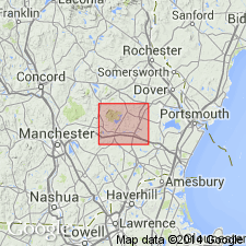
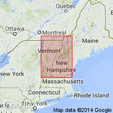
Named as member of Eliot formation. Named for Calef Road. Exposed in narrow belt between villages of Epping (Rockingham Co.) and Lee (Stafford Co.), Mount Pawtuckaway 15-min quad, southeastern NH. Consists chiefly of black phyllite with some green quartz-chlorite phyllite. Maximum thickness is 800 feet. Occurs at top of Eliot formation. Is overlain by Berwick formation. Age is Silurian(?).
Source: GNU records (USGS DDS-6; Reston GNULEX).
- Usage in publication:
-
- Calef member*
- Modifications:
-
- Age modified
- AAPG geologic province:
-
- New England province
Summary:
Age changed to probably Ordovician and Silurian.
Source: GNU records (USGS DDS-6; Reston GNULEX).
- Usage in publication:
-
- Calef Member*
- Modifications:
-
- Age modified
- AAPG geologic province:
-
- New England province
Summary:
The age of the Eliot Formation in NH is probable Silurian based on tentative correlation with similar rocks in central ME (Osberg, 1968). [This implies a revised age of the Calef Member of the Eliot, even though the Calef is not mentioned in the report. Also, the Eliot is recognized in MA as a result of this report, but it is not known if the Calef is also extended into MA.]
Source: GNU records (USGS DDS-6; Reston GNULEX).

- Usage in publication:
-
- Calef Member*
- Modifications:
-
- Overview
- Age modified
- AAPG geologic province:
-
- New England province
Summary:
Used as Calef Member of Eliot Formation of Merrimack Group. Consists of black phyllite at western contact of Eliot Formation; separately mapped. Age of all formations in Merrimack Group changed to Ordovician(?) to Silurian(?) based on isotopic age determinations of approx 440 and 420 Ma from detrital zircons from Berwick Formation (of Merrimack Group) by J.N. Aleinikoff (oral commun., 1994). Report includes geologic map, cross sections, correlation chart, and four 1:500,000-scale derivative maps.
Source: GNU records (USGS DDS-6; Reston GNULEX).
For more information, please contact Nancy Stamm, Geologic Names Committee Secretary.
Asterisk (*) indicates published by U.S. Geological Survey authors.
"No current usage" (†) implies that a name has been abandoned or has fallen into disuse. Former usage and, if known, replacement name given in parentheses ( ).
Slash (/) indicates name conflicts with nomenclatural guidelines (CSN, 1933; ACSN, 1961, 1970; NACSN, 1983, 2005, 2021). May be explained within brackets ([ ]).