The National Geologic Map Database is migrating to a new infrastructure. We apologize for any service disruptions during this process.
|
|---|


- Usage in publication:
-
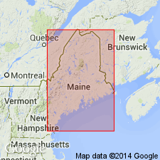
- Calais Formation
- Modifications:
-
- Named
- Biostratigraphic dating
- Dominant lithology:
-
- Shale
- Basalt
- AAPG geologic province:
-
- New England province
Summary:
Calais Formation is here formally named as the uppermost subdivision of the Cookson Group (rank raised). Unit represents only a small part of the original Cookson Formation outcrop belt of Ruitenberg (1967). The Black Shale Member at the base of the formation can be traced directly to the original type locality of the Cookson at Oak Bay, CAN. In Calais, ME, a thick Basalt Member and a distinctive Coticule Member, neither of which are exposed at Oak Bay, overlie the black slates. The Black Shale Member consists of sooty black sulfidic pelites with very few sandstone or siltstone beds. This basal member is intruded by the St. Stephen Gabbro and unnamed granitic and dioritic plutons. The base of the abruptly overlying Basalt Member consists of pillow basalts, which are overlain by pillow and massive basalts intercalated with black slates and phyllites. The Coticule Member above consists of layers, lenses, and pods of pink garnet--quartz rock within a fine-grained matrix of biotite-rich quartzofeldspathic siltstone. The Calais conformably overlies the Woodland Formation (new name) and unconformably underlies the Oak Bay Formation. Contact may be tectonic. Minimum thickness of unit is estimated at 1,000 m. Probably correlates with the Penobscot Formation (in part) to the south. Age is Early Ordovician (Tremadocian) based on graptolites (Ruitenberg and Ludman, 1978).
Source: GNU records (USGS DDS-6; Reston GNULEX).
- Usage in publication:
-
- Calais Formation
- Modifications:
-
- Revised
- AAPG geologic province:
-
- New England province
Summary:
Stratigraphic order of the formations within the Cookson Group is here revised based on new fossil evidence. Ascending, these units are Calais, Woodland, Pocomoonshine Lake, and Kendall Mountain Formations. The Digdeguash, previously considered Silurian, is here included in the Cookson as an equivalent of the Woodland and Pocomoonshine Lake formations. Kendall Mountain, once thought to be Cambrian and placed at the base of the Cookson, contains Caradocian graptolites and is now considered the youngest preserved part of the Group. Calais Formation has been dated as Arenigian. [Tremadocian according to Ludman, 1987.]. Therefore, Cookson ranges from Early to Middle [Late] Ordovician.
Source: GNU records (USGS DDS-6; Reston GNULEX).

- Usage in publication:
-
- Calais Formation
- Modifications:
-
- Overview
- AAPG geologic province:
-
- New England province
Summary:
Author disagrees, in part, with revisions of Cookson proposed by Fyffe and Riva (1990). Though he agrees that fossil evidence requires inversion of the stratigraphic sequence, he states that the Pocomoonshine Lake and Digdeguash formations are more likely a part of the Fredericton belt rather than of the St. Croix terrane and therefore are not part of the Cookson Group. Interpretation is based on lithologic and structural evidence. As here revised the Late Cambrian(?) to Middle Ordovician Cookson comprises (ascending) Calais, Woodland, and Kendall Mountain Formations. Cookson Group tectonically underlies (ascending) Pocomoonshine Lake, Digdeguash, and Flume Ridge Formations.
Source: GNU records (USGS DDS-6; Reston GNULEX).
- Usage in publication:
-
- Calais Formation
- Modifications:
-
- Overview
- AAPG geologic province:
-
- New England province
Summary:
Pocomoonshine Gabbro-Diorite intrudes the Pocomoonshine Lake, Digdeguash, and Flume Ridge Formations in the Fredericton belt and cuts the Kendall Mountain and Woodland Formations of the Cookson Group in the St. Croix belt. The pluton was emplaced during two separate episodes during the Silurian Period. 40Ar/39Ar hornblende ages form the northern mafic portion indicate crystallization at 422.7+/-3.0 Ma. Muscovite plateau age of 414.2+/-3.2 Ma is minimum age for central and southern dioritic portions of the pluton. Therefore, deposition of the Pocomoonshine Lake, Digdeguash, and Flume Ridge Formations is constrained to Late Caradocian (early Late Ordovician) through Early Silurian. The Cookson Group is interpreted as Late Cambrian(?) through Late Ordovician. Calais Formation at the base of the Group is shown as Late Cambrian(?) and Early Ordovician. According to authors, a major episode of folding and regional metamorphism must have taken place during the Silurian. Melding of the Fredericton, St. Croix, and Coastal Volcanic belts into a single block must have occurred by the Silurian. Accretion of this composite block to ancestral North America, then, was probably responsible for the Acadian Orogeny in northern New England.
Source: GNU records (USGS DDS-6; Reston GNULEX).
For more information, please contact Nancy Stamm, Geologic Names Committee Secretary.
Asterisk (*) indicates published by U.S. Geological Survey authors.
"No current usage" (†) implies that a name has been abandoned or has fallen into disuse. Former usage and, if known, replacement name given in parentheses ( ).
Slash (/) indicates name conflicts with nomenclatural guidelines (CSN, 1933; ACSN, 1961, 1970; NACSN, 1983, 2005, 2021). May be explained within brackets ([ ]).