- Usage in publication:
-
- Cahava Ranch Terrace deposits
- Modifications:
-
- Named
- Dominant lithology:
-
- Gravel
- Sand
- Caliche
- AAPG geologic province:
-
- Basin-and-Range province
Summary:
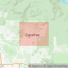
Named [informally] for Cahava Ranch Rd. Type locality near its junction with Cave Creek, Cave Creek quad, northern Maricopa Co., central AZ. Paired terrace deposits along Cave Creek lie 25 to 50 feet above modern stream bed; also called "middle Cave Creek terrace gravels". Primarily consist of tan to brown, moderately to poorly sorted, unconsolidated, rounded to subrounded sand and gravel-sized clasts in brown to reddish-brown sandy-silt matrix; thin caliche rinds and minor amounts of plugged caliche within zone 3 to 10 feet thick. Total thickness varies from 3 to 33 feet (Gorey, 1990). Called strath terrace [deposits] in Go John Mountain area, where they lie unconformably over Precambrian meta-argillite--phyllite complex and Middle Proterozoic (1400 Ma) Go John Diorite (new); become fill terrace [deposits] on eastern and northwestern sides of Cave Creek, where they overlie late Miocene and early Pliocene Galloway and Naked Girl Canyon Members of Carefree Formation (all new). Grade laterally into Pleistocene Horny Toad Terrace deposits (new, [informal]) and Pleistocene Schoolhouse Glacis Alluvium (new). Correlate with late Cenozoic Blue Point Terrace [deposits] of Salt River (Pewe, 1978). Age is Pleistocene. Report includes geologic map and cross section, and stratigraphic nomenclature table.
Source: GNU records (USGS DDS-6; Denver GNULEX).
For more information, please contact Nancy Stamm, Geologic Names Committee Secretary.
Asterisk (*) indicates published by U.S. Geological Survey authors.
"No current usage" (†) implies that a name has been abandoned or has fallen into disuse. Former usage and, if known, replacement name given in parentheses ( ).
Slash (/) indicates name conflicts with nomenclatural guidelines (CSN, 1933; ACSN, 1961, 1970; NACSN, 1983, 2005, 2021). May be explained within brackets ([ ]).

