- Usage in publication:
-
- Caddo limestone*
- Modifications:
-
- Original reference
- Dominant lithology:
-
- Limestone
- Clay
- Marl
- AAPG geologic province:
-
- Ouachita folded belt
Summary:
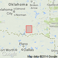
Caddo limestone. Clay, calcareous marls interstratified with white or yellowish marly limestone, and semi-crystalline limestone, marly beds thickest near base, lower 60 feet being composed chiefly of clay marls. Top member of formation is bed of oyster shells. Thickness of formation 150 feet. Underlies Bokchito formation and overlies Kiamichi formation. Recognized in southeastern and central southern Oklahoma. Age is Early Cretaceous (Comanche).
Named from Caddo, Byran Co., southeastern OK.
Source: US geologic names lexicon (USGS Bull. 896, p. 312).

- Usage in publication:
-
- Caddo Limestone
- Modifications:
-
- Mapped 1:250k
- Dominant lithology:
-
- Limestone
- Marl
- AAPG geologic province:
-
- South Oklahoma folded belt
Summary:
Pamphlet [p. 5-6]. Caddo Formation. Recognized in Oklahoma. Age is Early Cretaceous. [Consists of (descending): (1) upper part, white to gray limestone, cream-colored in upper 7 feet, correlative with Fort Worth Limestone of Texas; and (2) finely laminated blue-gray shale and gray, silty, shaly limestone containing abundant large cephalopods, correlative with Duck Creek Formation of Texas. (See also entries under Duck Creek and Fort Worth.) Mapped in Marietta area, Love Co., southeastern OK; along northern edge of map sheet.]
Source: Publication.
For more information, please contact Nancy Stamm, Geologic Names Committee Secretary.
Asterisk (*) indicates published by U.S. Geological Survey authors.
"No current usage" (†) implies that a name has been abandoned or has fallen into disuse. Former usage and, if known, replacement name given in parentheses ( ).
Slash (/) indicates name conflicts with nomenclatural guidelines (CSN, 1933; ACSN, 1961, 1970; NACSN, 1983, 2005, 2021). May be explained within brackets ([ ]).

