The National Geologic Map Database is migrating to a new infrastructure. We apologize for any service disruptions during this process.
|
|---|


- Usage in publication:
-
- Caddell clays
- Modifications:
-
- Original reference
- Dominant lithology:
-
- Clay
- AAPG geologic province:
-
- Gulf Coast basin
Summary:
Pg. 462. Caddell clays. At base greenish clays and sandy clays with some sand and greensand, which are iron-stained. These weather dark-brown and carry calcareous concretions, which contain more or less sand and greensand, and are geodic in places. These are overlain by grayish-brown sandy clays with seams of sulphur, which are followed by buff sandy clays with plant fragments, and gray-drab clays with gypsum and sulphur. Included in Jackson beds. Separated from overlying Manning beds by clays and sands, and separated from underlying Frio clays by clays and sands that are believed to be the Wellborn. [E.T. Dumble, 1920 (Univ. Texas Bull., no. 1869), called the beds underlying his Caddell clay the Wellborn sandstone.]
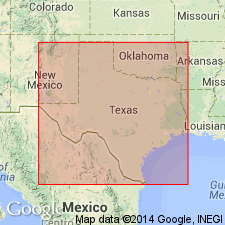
Named from excellent exposures around Caddell, San Augustine Co., [northeastern TX].
Source: US geologic names lexicon (USGS Bull. 896, p. 311-312).
- Usage in publication:
-
- Caddell formation
- Modifications:
-
- Revised
- Biostratigraphic dating
- AAPG geologic province:
-
- Gulf Coast basin
Summary:
Caddell formation, of Jackson group, is divided into upper chocolate phase and lower marl phase. It is overlain by McElroy formation (which is divided into (descending) 3 mappable units, namely, Manning beds, Wellborn sands, and Wooley's Bluff clays), and rests conformably on the Cockfield [Yegua] formation. Thickness 150 to 300 feet. [Fossils listed.]
Source: US geologic names lexicon (USGS Bull. 896, p. 311-312).

- Usage in publication:
-
- Caddell member
- Modifications:
-
- Revised
- AAPG geologic province:
-
- Gulf Coast basin
Summary:
Pg. 685-686. Caddell member of Fayette formation was named by Dumble. It comprises 30 to 45 feet of basal strata of the Fayette of northeastern Texas, which consists of chocolate-colored and greenish clays that weather to brownish and purplish hues and contain dark-brown, calcareous, fossiliferous sandstone concretions, large amount of selenite crystals, and minor amounts of glauconite. Some of clay near top contains layers of fine sand 1 inch or less in thickness. Rests on Yegua formation and is overlain by Wellborn sandstone of Kennedy. Miss Ellisor (ms.) during recent detailed subsurface studies has been able to recognize this member in well sections throughout the Gulf Coast district. Lower part of Caddell member of Dumble is characterized by TEXTULARIA DIBOLLENSIS. Dividing line between Caddell and overlying McElroy member is drawn at base of Wellborn sandstone. Age is late Eocene.
Source: US geologic names lexicon (USGS Bull. 896, p. 311-312).
- Usage in publication:
-
- Caddell formation
- Modifications:
-
- Revised
- Dominant lithology:
-
- Sand
- Clay
- AAPG geologic province:
-
- Gulf Coast basin
Summary:
Table opp. p. 17, and p. 17-23. Caddell formation (Moodys marl) of Walker County to Gonzales County region is 100 to 200 feet thick; is basal formation of Jackson group. It underlies Wellborn formation (the basal member of which is Bedias sandstone), conformably overlies Yegua formation, and consists of (1) an upper member of chocolate-colored shales and sands, locally lignitic; nonmarine beds and interbedded marine glauconitic shales; and (2) a lower member, 0 to 25 feet thick, of gray calcareous sandstone, locally with ferruginous concretions and locally fossiliferous. Dumble confused position of Caddell formation when he stated that it overlies Wellborn. [Exposures of Caddell are listed.] The Wooley's Bluff clays of Ellisor are part of Wellborn. At fresh exposures in Angelina County and in cores from wells the Caddell formation is essentially a fossiliferous glauconitic marl. From western Walker County to Gonzales County the Caddell formation is mostly gray and tan cross-bedded sands and gray and chocolate-colored clays. The glauconitic marl of Caddell formation is similar in lithology and stratigraphic position to Moodys marl of Mississippi, and since Moodys has priority perhaps it should be adopted for basal formation of the Jackson in Texas.
Source: US geologic names lexicon (USGS Bull. 896, p. 311-312).
- Usage in publication:
-
- Caddell formation*
- Modifications:
-
- Principal reference
- Adopted
- AAPG geologic province:
-
- Gulf Coast basin
Summary:
Pg. 2624 (fig. 1), 2626-2627. Caddell formation of Jackson group. Formation at base of Jackson group. Consists of glauconitic very fine sand, silt, and clay; calcareous and ferruginous concretions near base; marine beds locally interbedded with chocolate lignitic clays and sands. Underlies Wellborn sandstone. Type locality designated. Dumble's locality not located with certainty. Age is late Eocene.
Type locality: cuts along Highway 147 just west of relocated bridge, 4 mi west of site of Caddell, San Augustine Co., south-central TX.
Source: US geologic names lexicon (USGS Bull. 1200, p. 570-571).
- Usage in publication:
-
- Caddell Formation
- Modifications:
-
- Mapped 1:250k
- Dominant lithology:
-
- Clay
- Sand
- AAPG geologic province:
-
- Gulf Coast basin
Summary:
Pamphlet [p. 3]. Caddell Formation. Clay and quartz sand. Clay sandy, lignitic, brown. Sand, very fine-grained, glauconitic, glauconitic ironstone concretions common. Thickness 50 to 150 feet, thickens westward. Lies above Yegua Formation and below Wellborn Formation. Age is Eocene.
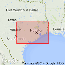
[Mapped in Grimes and Walker Cos., TX.]
Source: Publication.

- Usage in publication:
-
- Caddell Formation
- Modifications:
-
- Mapped 1:250k
- Dominant lithology:
-
- Clay
- Sandstone
- Siltstone
- AAPG geologic province:
-
- Gulf Coast basin
Summary:
Caddell Formation. Clay, sandstone, and siltstone; clay, lignitic, bentonitic, locally fossiliferous; sandstone, fine- to medium-grained, subangular quartz, poorly sorted, some black chert, glauconitic, calcareous; siltstone, tuffaceous, blocky fracture, light yellowish brown to brown; forms dark gray soil. Thickness 50 to 100 feet. Overlies Yegua Formation (Eocene); underlies Wellborn Formation (Eocene). Age is Eocene.
Mapped in Wilson, Karnes, Gonzales, and Fayette Cos., southeastern TX.
Source: Modified from GNU records (USGS DDS-6; Denver GNULEX).

- Usage in publication:
-
- Caddell Formation
- Modifications:
-
- Mapped 1:250k
- Dominant lithology:
-
- Siltstone
- Clay
- Sandstone
- AAPG geologic province:
-
- Gulf Coast basin
Summary:
Caddell Formation of Jackson Group. Siltstone, clay, and sandstone; siltstone, tuffaceous, blocky fracture; clay, bentonitic, locally fossiliferous; sandstone, very fine-grained, glauconitic, light gray to olive; generally poorly exposed, weathers to dark reddish-brown soil. Thickness 50 feet. Basal formation of Jackson Group. Lies below Wellborn Sandstone of Jackson Group and above Yegua Formation. Age is Eocene.
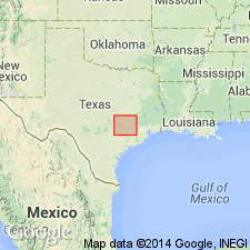
[Mapped in Atascosa, Wilson, and McMullen Cos., southern TX.]
Source: Publication.

- Usage in publication:
-
- Caddell Formation
- Modifications:
-
- Mapped 1:250k
- Dominant lithology:
-
- Siltstone
- Clay
- Sandstone
- AAPG geologic province:
-
- Gulf Coast basin
Summary:
Pamphlet [p. 2]. Caddell Formation. Siltstone, clay, and sandstone; siltstone, tuffaceous, blocky fracture; clay, bentonitic, locally fossiliferous; sandstone, very fine-grained, glauconitic, light-gray to olive; generally poorly exposed, produces dark reddish-brown soil. Thickness 50 feet. Overlies Yegua Formation; underlies Wellborn Formation. Age is Eocene.
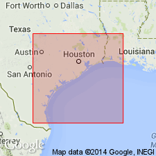
[Two slivers mapped in southeasternmost corner of map sheet along Wilson-Karnes Co. line, southern TX.]
Source: Publication.
For more information, please contact Nancy Stamm, Geologic Names Committee Secretary.
Asterisk (*) indicates published by U.S. Geological Survey authors.
"No current usage" (†) implies that a name has been abandoned or has fallen into disuse. Former usage and, if known, replacement name given in parentheses ( ).
Slash (/) indicates name conflicts with nomenclatural guidelines (CSN, 1933; ACSN, 1961, 1970; NACSN, 1983, 2005, 2021). May be explained within brackets ([ ]).