

- Usage in publication:
-
- Cabezon fanglomerate
- Modifications:
-
- Original reference
- Dominant lithology:
-
- Fanglomerate
- AAPG geologic province:
-
- Salton basin
Summary:
Pg. 344, 387-392, and map. Cabezon fanglomerate. A fanglomerate deposited in Bear and Holcomb Valleys. Differs from older Coachella fanglomerate in being more uniform and massive, of yellowish color, and in lying nearly horizonal. The largest area in Bear Valley is broad flat between Rathbone Creek and Erwin Lake, where material is almost wholly unsorted angular and subangular quartzite brought down from Sugarloaf Mountain to southeast. Holcomb Valley is nearly surrounded by flat ridges of fanglomerate. Those on south and east sides are particularly conspicuous and consist of limestone, granite, and quartzite from surrounding hills. The fanglomerate in Bear and Holcomb Valleys is only local representative of a widespread deposition during third cycle of erosion. The Cabezon fanglomerate is older than Heights fanglomerate, and younger than Coachella fanglomerate. Age is Quaternary.
Source: US geologic names lexicon (USGS Bull. 896, p. 308-309).
- Usage in publication:
-
- Cabezon fanglomerate
- Modifications:
-
- Revised
- Dominant lithology:
-
- Conglomerate
- AAPG geologic province:
-
- Salton basin
Summary:
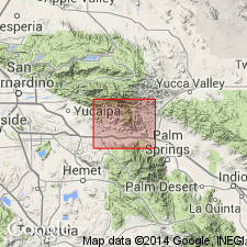
Pg. 324 (fig. 2), 325 (table 1), 331, pls. 1, 3. Cabezon fanglomerate. Described in San Gorgonio Pass area as a gray to tan ill-sorted conglomerate rich in clasts of pegmatitic and granitic rocks. Maximum thickness about 1,500 feet. Unconformably underlies Heights fanglomerate; unconformably overlies Painted Hill formation, angular unconformity on wall of Stubby Canyon is tentatively regarded as the contact, although it may be a local angular unconformity within the Cabezon section. Age is Quaternary. Type area suggested.
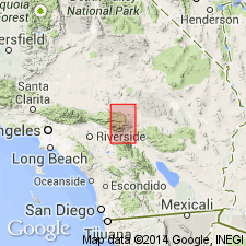
[Type area apparently in foothills north of Cabazon [previously spelled Cabezon]. Named from Cabezon Station, Riverside Co., San Bernardino Mountains, southeastern CA. Post office now spelled Cabazon, but Vaughan used the Indian spelling Cabezon and this is retained as formation name.]
Source: US geologic names lexicon (USGS Bull. 1200, p. 566).
For more information, please contact Nancy Stamm, Geologic Names Committee Secretary.
Asterisk (*) indicates published by U.S. Geological Survey authors.
"No current usage" (†) implies that a name has been abandoned or has fallen into disuse. Former usage and, if known, replacement name given in parentheses ( ).
Slash (/) indicates name conflicts with nomenclatural guidelines (CSN, 1933; ACSN, 1961, 1970; NACSN, 1983, 2005, 2021). May be explained within brackets ([ ]).