The National Geologic Map Database is migrating to a new infrastructure. We apologize for any service disruptions during this process.
|
|---|


- Usage in publication:
-
- Cabbage Patch beds
- Modifications:
-
- Overview
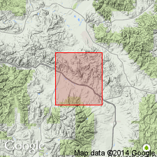
- AAPG geologic province:
-
- Montana folded belt
Summary:
Underlies Flint Creek beds and is younger than the Golden Spike facies (new) of the Cretaceous Elkhorn Mountains Volcanics of latest Cretaceous age. Ranges from 0-500 ft thick in report area, Powell Co, MT, Montana folded belt province. Persists eastward into Gold Creek basin. Absent in eastern Flint Creek basin. Are 400-650 ft thick in Clark Fork valley. Of lacustrine and fluvial origin. Distinguished from overlying Flint Creek by predominance of massive bedding and by presence of feldspathic-micaceous conglomerate and sandstone. Of Tertiary age.
Source: GNU records (USGS DDS-6; Denver GNULEX).
For more information, please contact Nancy Stamm, Geologic Names Committee Secretary.
Asterisk (*) indicates published by U.S. Geological Survey authors.
"No current usage" (†) implies that a name has been abandoned or has fallen into disuse. Former usage and, if known, replacement name given in parentheses ( ).
Slash (/) indicates name conflicts with nomenclatural guidelines (CSN, 1933; ACSN, 1961, 1970; NACSN, 1983, 2005, 2021). May be explained within brackets ([ ]).