- Usage in publication:
-
- Cabaniss group
- Modifications:
-
- Areal extent
- AAPG geologic province:
-
- Forest City basin
Summary:
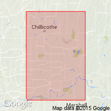
(Searight, IN Howe and Searight, 1953, Missouri Geol. Survey and Water Res. Rpt. Inv., no. 14, pl. 1). Cabaniss group. Geographically extended into Carroll and Livingston Counties, western Missouri, where it comprises (ascending) Croweburg, Verdigris, Wheeler, Bevier, Lagonda, and Excello formations. Age is Middle Pennsylvanian (Des Moines).
Source: US geologic names lexicon (USGS Bull. 1200, p. 565-566).
- Usage in publication:
-
- Cabaniss group
- Modifications:
-
- Original reference
- AAPG geologic province:
-
- Arkoma basin
- Chautauqua platform
Summary:
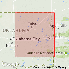
Pg. 1524 (fig. 1), 1526. Cabaniss group. Defined to include all rocks that crop out above Krebs group (new) and below base of Marmaton group. Extends from northeast flank of Arbuckle Mountains northeastward to Kansas-Oklahoma line and comprises (ascending) Thurman sandstone, Stuart shale, and Senora formation. In northern Oklahoma, top of group is base of Fort Scott limestone; between Arkansas River and Arbuckle Mountains base is Calvin limestone. Thickness 1,000 feet in latitude of Cabaniss; thins southwestward and northeastward due to overlap of lower units by higher as well as thinning within units; about 200 feet along Arbuckle Mountains; 350 feet at Arkansas River; 160 feet at Kansas-Oklahoma line. Krebs and Cabaniss groups together are nearly but not quite the same stratigraphically as Cherokee rocks of southeastern Kansas. Age is Middle Pennsylvanian (Des Moines).
Named from village of Cabaniss, in T. 6 N., R. 12 E., northwestern Pittsburg Co., OK.
Source: US geologic names lexicon (USGS Bull. 1200, p. 565-566).
- Usage in publication:
-
- Cabaniss group
- Modifications:
-
- Revised
- AAPG geologic province:
-
- Arkoma basin
- Chautauqua platform
- Forest City basin
Summary:
Pg. 2748 (fig. 1). Cabaniss group. Shown on northern Midcontinent composite stratigraphic section as comprising following formations (ascending): Weir, Tebo, Scammon, Mineral, Robinson Branch (new), Fleming, Croweburg, Verdigris, Bevier, Lagonda, Mulky, and Excello formations. Overlies Krebs group; underlies Marmaton group. Age is Middle Pennsylvanian (Des Moines; Cygnian substage).
Source: US geologic names lexicon (USGS Bull. 1200, p. 565-566).
- Usage in publication:
-
- Cabaniss subgroup [informal]
- Modifications:
-
- Revised
- AAPG geologic province:
-
- Cherokee basin
- Forest City basin
Summary:
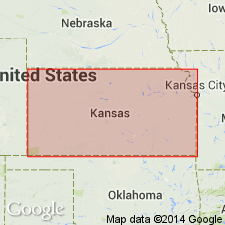
Pg. 22 (fig. 5), 44-46. Cabaniss subgroup [informal]. Term Cherokee group readopted, and Cabaniss reduced in rank of subgroup [informal]. In southeastern Kansas, Cabaniss succession extended from top of Seville limestone in Krebs subgroup [informal] to base of Blackjack Creek limestone, which is lower Marmaton. Thickness about 200 feet. Age is Middle Pennsylvanian (Des Moines).
["Subgroup" not recognized as a formal stratigraphic rank term (CSN, 1933; ACSN, 1961, 1970; NACSN, 1983, 2005, 2021). Considered informal and should not be capitalized.]
Source: US geologic names lexicon (USGS Bull. 1200, p. 565-566).
- Usage in publication:
-
- Cabaniss Group
- Modifications:
-
- Revised
- AAPG geologic province:
-
- Chautauqua platform
Summary:
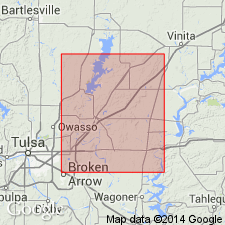
A 6-21 ft thick sandstone about 142 ft below top of Senora Formation of Cabaniss Group named Oowala Limestone Member of Senora. Senora is the only formation in the Cabaniss Group in report area. Cabaniss overlies Boggy Formation of Krebs Group and underlies Fort Scott Formation of Marmaton Group. Report area lies on the Chautauqua platform of OK.
Source: GNU records (USGS DDS-6; Denver GNULEX).
For more information, please contact Nancy Stamm, Geologic Names Committee Secretary.
Asterisk (*) indicates published by U.S. Geological Survey authors.
"No current usage" (†) implies that a name has been abandoned or has fallen into disuse. Former usage and, if known, replacement name given in parentheses ( ).
Slash (/) indicates name conflicts with nomenclatural guidelines (CSN, 1933; ACSN, 1961, 1970; NACSN, 1983, 2005, 2021). May be explained within brackets ([ ]).

