

- Usage in publication:
-
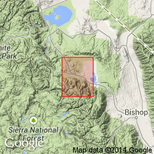
- Buzztail Spring formation*
- Modifications:
-
- Named
- Dominant lithology:
-
- Hornfels
- Slate
- Sandstone
- Marble
- AAPG geologic province:
-
- Sierra Nevada province
Summary:
Named for Buzztail Spring on north side of McGee Creek which is designated type locality in southeastern part of Mount Morrison 15' quad, Sierra Nevada, CA. Composed of interlayered generally dark-colored pelitic hornfels and slate, siliceous hornfels, metachert, calcareous quartz sandstone, and marble in beds typically ranging from few inches to few ft thick. Includes light-colored quartz sandstone member about 350 ft thick in upper part. This member interpreted as formerly continuous stratigraphic unit that has been deformed by faulting and tight folding. Thickness is about 2500 ft. Is in fault contact with older rocks on east. Upper contact with Mount Aggie formation (new) is depositional. Discontinuously exposed over strike length of about 4 mi. Unit and sandstone member shown on geologic map of Morrison 15' quad as part of Convict Lake block. Assigned Ordovician(?) age. [no basis given]
Source: GNU records (USGS DDS-6; Menlo GNULEX).
For more information, please contact Nancy Stamm, Geologic Names Committee Secretary.
Asterisk (*) indicates published by U.S. Geological Survey authors.
"No current usage" (†) implies that a name has been abandoned or has fallen into disuse. Former usage and, if known, replacement name given in parentheses ( ).
Slash (/) indicates name conflicts with nomenclatural guidelines (CSN, 1933; ACSN, 1961, 1970; NACSN, 1983, 2005, 2021). May be explained within brackets ([ ]).