- Usage in publication:
-
- Buzzard Rock Member*
- Modifications:
-
- Named
- Dominant lithology:
-
- Rhyolite
- AAPG geologic province:
-
- Appalachian basin
Summary:
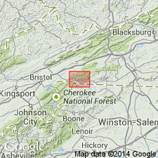
Named as a member of Mount Rogers Formation in Mount Rogers volcanic center. Named for Buzzard Rock, a shoulder of Whitetop Mountain, southwest corner of Whitetop Mountain 7.5-min quad, southwestern VA. Previously called unit C by Rankin (1967) and Rankin and others (1974). Consists of low-silica rhyolite with grayish-purple or maroon, aphanitic groundmass and 5 to 20 percent phenocrysts of perthitic alkali feldspar and plagioclase in subequal amounts. Reddish perthite and greenish-white plagioclase give rock a distinctive appearance. Observations of flow layering indicate lava flows; layering is not obvious at Buzzard Rock but may be seen in roadcuts between elevation of 4760 and 4880 ft on Grayson Highlands State Park Rd on west side of Haw Orchard Mountain. On southwest side of Haw Orchard Mountain, Buzzard Rock is about 300 m thick and consists of at least two flows separated by maroon arkose. In thrust slice above Trout Dale fault, Buzzard Rock Member is about 350 m thick on east side of Elk Ridge. Discontinuous beneath Whitetop Rhyolite Member (new); locally in contact with Middle Proterozoic Cranberry Gneiss. Interfingers with both greenstone and tuffaceous rocks along southern slopes of Mount Rogers and Haw Orchard Mountain. Age is Late Proterozoic. Report includes geologic map.
Source: GNU records (USGS DDS-6; Reston GNULEX).
For more information, please contact Nancy Stamm, Geologic Names Committee Secretary.
Asterisk (*) indicates published by U.S. Geological Survey authors.
"No current usage" (†) implies that a name has been abandoned or has fallen into disuse. Former usage and, if known, replacement name given in parentheses ( ).
Slash (/) indicates name conflicts with nomenclatural guidelines (CSN, 1933; ACSN, 1961, 1970; NACSN, 1983, 2005, 2021). May be explained within brackets ([ ]).

