The National Geologic Map Database is migrating to a new infrastructure. We apologize for any service disruptions during this process.
|
|---|


- Usage in publication:
-
- Buzzard Peak conglomerate member*
- Modifications:
-
- Named
- Dominant lithology:
-
- Conglomerate
- Sandstone
- Siltstone
- AAPG geologic province:
-
- Transverse Ranges province
Summary:
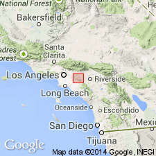
Named as member of Topanga formation. Crops out in core of Buzzard Peak anticline in San Jose Hills, 5 mi west of Pomona [San Dimas 7.5' quad] Los Angeles Co, CA. Consists of sandy conglomerate and coarse-grained pebbly sandstone with few beds of white siliceous siltstone. Is about 2000 ft thick; base not exposed but overlies volcanic rocks in Continental Oil Bayly well no.1 at depth of 2300 ft. Conformably underlies lower member of Puente formation or intervening andesite breccia. Is middle Miocene age based on stratigraphic relations.
Source: GNU records (USGS DDS-6; Menlo GNULEX).
For more information, please contact Nancy Stamm, Geologic Names Committee Secretary.
Asterisk (*) indicates published by U.S. Geological Survey authors.
"No current usage" (†) implies that a name has been abandoned or has fallen into disuse. Former usage and, if known, replacement name given in parentheses ( ).
Slash (/) indicates name conflicts with nomenclatural guidelines (CSN, 1933; ACSN, 1961, 1970; NACSN, 1983, 2005, 2021). May be explained within brackets ([ ]).