The National Geologic Map Database is migrating to a new infrastructure. We apologize for any service disruptions during this process.
|
|---|


- Usage in publication:
-
- Buttonbed Sandstone Member*
- Modifications:
-
- Named
- Reference
- Biostratigraphic dating
- Dominant lithology:
-
- Sandstone
- AAPG geologic province:
-
- California Coast Ranges province
Summary:
Pg. 22-23. Buttonbed Sandstone Member, uppermost of 6 members of Temblor Formation. "Anderson (1905) referred to top sandstone unit of his Temblor Beds at Carneros Creek as 'button beds'." Term has subsequently been applied informally to this sandstone (Kleinpell, 1938; Foss and Blaisdell, 1968). Composed of light-gray, thick-bedded sandstone, and commonly is calcareous with numerous shell fragments. Thickness ranges from 0 to 150 m. Overlies or intertongues with Media Shale Member of Temblor Formation. Conformably underlies Gould Shale Member of Monterey Shale. Age is middle Miocene (Temblor age), based on biostratigraphic dating of mollusks and button-like echinoids (mostly SCUTELLA MERRIAMI). (Buttonbed Sandstone Member of Temblor Formation adopted by the USGS.)
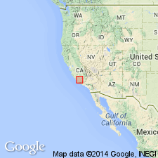
Named from exposures at Buttonbed Hill, Temblor Range, Kern Co., southern CA.
Type locality: exposures in Carneros Creek, in sec. 32, T. 28 S., R. 20 E., Temblor Range, Kern Co., southern CA (Heikkila and MacLeod, 1951).
Reference section: exposures in Zemorra Creek, in sec. 9, T. 29 S., R. 20 E.
Source: GNU records (USGS DDS-6; Menlo GNULEX); Changes in stratigraphic nomenclature, 1973 (USGS Bull. 1395-A, p. A8-A9); US geologic names lexicon (USGS Bull. 1520, p. 44).
For more information, please contact Nancy Stamm, Geologic Names Committee Secretary.
Asterisk (*) indicates published by U.S. Geological Survey authors.
"No current usage" (†) implies that a name has been abandoned or has fallen into disuse. Former usage and, if known, replacement name given in parentheses ( ).
Slash (/) indicates name conflicts with nomenclatural guidelines (CSN, 1933; ACSN, 1961, 1970; NACSN, 1983, 2005, 2021). May be explained within brackets ([ ]).