

- Usage in publication:
-
- Butte Falls tuff*
- Modifications:
-
- Named
- Dominant lithology:
-
- Tuff
- Slate
- Schist
- AAPG geologic province:
-
- Southwestern Basin-and-Range region
Summary:
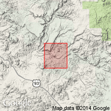
Is named for Butte Falls [not shown on geologic map base] on Boulder Creek in Bagdad area, Yavapai Co, AZ, Southwestern Basin-and-Range region, as middle formation of Yavapai series. No type locality designated. Smaller outcrops exposed on Bozarth Mesa, east of Lucy Peak, south of Mountain Spring, and along Maroney Gulch. Is more than 2,500 ft thick. Made up of quartz-sericite schist, quartz-feldspar-biotite schist, and gray to purple slate. Original bedding rarely preserved. Intruded by Lawler Peak granite (new). It accumulated as a series of water deposited sediments of volcanic derivation although some massive beds may represent subaerial accumulation of pyroclastic material. Relationship to the older Bridle formation (new) of Yavapai or the younger Hillside mica schist (new) not known. Is pre-Cambrian. Geologic map.
Source: GNU records (USGS DDS-6; Denver GNULEX).
- Usage in publication:
-
- Butte Falls Tuff
- Modifications:
-
- Not used
Summary:
Name not used. Rocks formerly called Butte Falls Tuff mapped as part of a mixed [meta] volcanic sequence belonging to Butte Falls? Tuff and Hillside? Mica Schist that overlie Dick Rhyolite, Bagdad mining district, western Yavapai Co, AZ in the Southwestern Basin-and-Range region. Geologic map provided extending coverage just south and west of map by Anderson, Scholz, and Strobell, Jr., (1955). Rocks formerly assigned to Butte Falls Tuff referred to as felsic, tuffaceous, and schistose rocks east of the Mountain Spring fault. Southward, similar rocks are mafic volcanics. These informally designated units could be younger than volcanic rocks of the Yavapai Series in the Jerome-Prescott area to the east. Is of Early Proterozoic age.
Source: GNU records (USGS DDS-6; Denver GNULEX).
For more information, please contact Nancy Stamm, Geologic Names Committee Secretary.
Asterisk (*) indicates published by U.S. Geological Survey authors.
"No current usage" (†) implies that a name has been abandoned or has fallen into disuse. Former usage and, if known, replacement name given in parentheses ( ).
Slash (/) indicates name conflicts with nomenclatural guidelines (CSN, 1933; ACSN, 1961, 1970; NACSN, 1983, 2005, 2021). May be explained within brackets ([ ]).