- Usage in publication:
-
- Butte Creek Volcanic Sandstone
- Modifications:
-
- Named
- Biostratigraphic dating
- Geochronologic dating
- Dominant lithology:
-
- Volcaniclastics
- AAPG geologic province:
-
- Snake River basin
Summary:
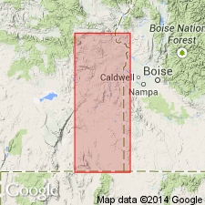
Named for volcanic sandstones and volcanic-pebble conglomerates exposed along Butte Creek and at type section, in SW/4 SW/4 sec.23 T24S R40E, Wildcat Creek, Mahleur Co, OR. Measured section included in report. Thickness probably not more than 100 ft. Overlies Littlefield Rhyolite (new). Underlies Wildcat Creek Ash-Flow Tuff (new) in Crowley district. Underlies Tims Peak Basalt (new) in Monument Peak district. Contains Barstovian [upper lower Miocene Stage] mammalian fossils. K-Ar determination on sanidine collected from unit in Red Ridge Basin fossil quarry gave age of 15.1 Ma (Evernden and others, 1964). Age is considered Miocene.
Source: GNU records (USGS DDS-6; Menlo GNULEX).
For more information, please contact Nancy Stamm, Geologic Names Committee Secretary.
Asterisk (*) indicates published by U.S. Geological Survey authors.
"No current usage" (†) implies that a name has been abandoned or has fallen into disuse. Former usage and, if known, replacement name given in parentheses ( ).
Slash (/) indicates name conflicts with nomenclatural guidelines (CSN, 1933; ACSN, 1961, 1970; NACSN, 1983, 2005, 2021). May be explained within brackets ([ ]).

