The National Geologic Map Database is migrating to a new infrastructure. We apologize for any service disruptions during this process.
|
|---|


- Usage in publication:
-
- Butano sandstone*
- Modifications:
-
- Original reference
- Dominant lithology:
-
- Sandstone
- AAPG geologic province:
-
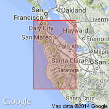
- Santa Cruz basin
Summary:
Butano sandstone. Massive brown and buff sandstones with conglomerate at base. Thickness about 2,100 feet. No fossils found. Conformably underlies San Lorenzo formation, and believed to unconformably overlie Eocene limestone, but sequence is concealed. Age is Oligocene? (may be Eocene).
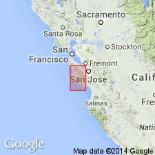
Named from exposures on Butano Ridge, Santa Cruz Mountains, San Mateo Co., southern CA.
Source: US geologic names lexicon (USGS Bull. 896, p. 304).
- Usage in publication:
-
- Butano sandstone*
- Modifications:
-
- [Principal reference]
- Areal extent
- Revised
- Age modified
- Biostratigraphic dating
- AAPG geologic province:
-
- California Coast Ranges province
Summary:
Pg. 184-186. Butano sandstone. Light-gray or very pale orange, medium-grained sandstone in beds 1 to 10 feet thick. Includes a pebble-and-cobble conglomerate, possibly 5,700 feet below top of formation, along Butano Ridge. No complete section of Butano sandstone has been found. Thickness thought to be approximately 9,000 feet. Upper 6,000 feet exposed on Butano Ridge and lower 3,000 feet between Scott and East Waddell Creeks. Appears to lie unconformably on Locatelli formation. Grades upward into lower shale member of San Lorenzo formation, except in a few places where contact is intruded by diabase. Fossils; chiefly Foraminifera, notably AMPHIMORPHINA JENKINSI (H.G. Schenck, 1936, GSA Spec. Paper 4, p. 69), and UVIGERINA CHURCHI and PLECTOFRONDICULARIA PACKARDI MULTILINEATA (E.E. Brabb, 1960, PhD Dissert. Stanford Univ., p. 185). Age is Eocene (Narizian stage of V.S. Mallory, 1959, Lower Tertiary biostratigraphy of the California Coast Ranges: Tulsa, OK, AAPG, 416 p.).
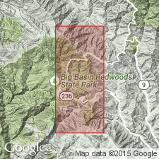
Type section [Principal reference section]: upper 1,700 ft exposed along Little Boulder Creek [in SW/4 sec. 22, SE/4 sec. 21, and N/2 sec. 28, T. 8 S., R. 3 W., near northern bdry. Big Basin Redwoods State Park], Big Basin 7.5-min quadrangle, San Mateo and Santa Cruz Cos., CA.
Representative sections: in headwaters of Opal Creek, Little Boulder Creek, and along the lumber road from Pescadero Creek to the crest of Butano Ridge, in sec. 17, T. 8 S., R. 3 W., Big Basin 7.5-min quadrangle, [within and around Big Basin Redwoods State Park, San Mateo and Santa Cruz Cos., CA]; and to northwest in Hoffman Creek, [La Honda 7.5-min quadrangle, near northwestren bdry. Pescadero Creek County Park, San Mateo Co., CA].
Source: Publication.
- Usage in publication:
-
- Butano Sandstone*
- Modifications:
-
- Age modified
- AAPG geologic province:
-
- California Coast Ranges province
Summary:
Consists of about 3000 m of light-gray to buff very fine- to very coarse-grained arkosic sandstone with dark-gray to brown mudstone and shale and with conglomerate present locally in lower part. Age is early and middle Eocene since Two-Bar Shale Member of San Lorenzo Formation which overlies unit is middle and late Eocene in age.
Source: GNU records (USGS DDS-6; Menlo GNULEX).
For more information, please contact Nancy Stamm, Geologic Names Committee Secretary.
Asterisk (*) indicates published by U.S. Geological Survey authors.
"No current usage" (†) implies that a name has been abandoned or has fallen into disuse. Former usage and, if known, replacement name given in parentheses ( ).
Slash (/) indicates name conflicts with nomenclatural guidelines (CSN, 1933; ACSN, 1961, 1970; NACSN, 1983, 2005, 2021). May be explained within brackets ([ ]).