The National Geologic Map Database is migrating to a new infrastructure. We apologize for any service disruptions during this process.
|
|---|


- Usage in publication:
-
- Bursum formation*
- Modifications:
-
- Original reference
- Dominant lithology:
-
- Shale
- Arkose
- Conglomerate
- Limestone
- AAPG geologic province:
-
- Estancia basin
- Orogrande basin
Summary:
Bursum formation of Magdalena group. In mapped area, about 30 miles north of type section, formation consists of dark-purplish-red and green shale in beds up to 40 feet thick, separated by thinner beds of arkose, arkosic conglomerate, and gray fossiliferous limestone. Locally, at base is a thin rubbly nodular purplish-gray limestone reworked from underlying Madera limestone. Thickness ranges from 28 to 234 feet. Underlies Abo formation; overlies upper arkosic limestone member of Madera limestone [=Atrasado member of Madera in Lucero uplift (Kelley and Wood, 1946)]. Fossils. Carries marine invertebrates, fusulinids SCHWAGERINA and very obese TRITICITES VENTRICOSUS. Age given as (Wolfcamp) Permian(?), based on fossils.
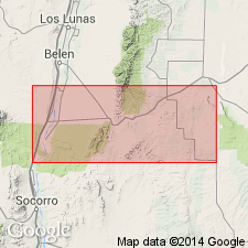
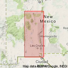
Type section: exposures about 30 mi south of geol. map bdry., just west of Bursum triangulation point, in SE/4 sec. 1, T. 6 S., R. 4 E., [approx. Lat. 33 deg. 48 min. 54 sec. N., Long. 106 deg. 28 min. 12 sec. W., Wrye Peak SW 7.5-min quadrangle, Jornado del Muerto area], Socorro Co., central NM. Mapped in areas along Socorro-Torrance Co. line and on flank of Los Pinos Mountains.
[Additional locality information from USGS historical topographic map collection TopoView, accessed May 7, 2018.]
Source: Publication; US geologic names lexicon (USGS Bull. 1200, p. 552-553).
- Usage in publication:
-
- Bursum formation
- Modifications:
-
- Revised
- AAPG geologic province:
-
- Orogrande basin
Summary:
Pg. 23, pl. 1. Bursum formation. [Excluded from Magdalena group (not used).] At type locality, formation is 250 feet thick and consists of shale, conglomerate, and arkosic sandstone in lower part, and marine limestone and shale in upper part. [Age is Early Permian (Wolfcamp).]
Source: US geologic names lexicon (USGS Bull. 1200, p. 552-553).
- Usage in publication:
-
- Bursum formation
- Modifications:
-
- Areal extent
- AAPG geologic province:
-
- Orogrande basin
Lloyd, E.R., 1949, Pre-San Andres stratigraphy and oil-producing zones in southeastern New Mexico; A progress report: New Mexico Bureau of Mines and Mineral Resources Bulletin, no. 29, 87 p., (incl. geologic maps)
Summary:
Pg. 32-33. Bursum formation. In discussing Pennsylvanian-Permian contact, Thompson (1942, New Mexico Bur. Mines Min. Res. Bull. 17) mentioned presence of fusulinid-bearing marine sediments of lower Wolfcamp age unconformably overlying Pennsylvanian rocks [Fresnal group] in a number of localities in south-central New Mexico. These lower Wolfcampian limestones received three different names in 1946. Kelley and Wood introduced name Red Tanks member of Madera limestone in Lucero uplift; Wilpolt and others introduced name Bursum for beds exposed in Los Pinos Mountains and vicinity of Abo Canyon; Stark and Dapples described same section and named it Aqua Torres formation. Name Bursum is preferred by New Mexico Bur. Mines Min. Res. Bruton formation (Thompson, 1942), of Pennsylvanian age, is very similar in lithology to Bursum, and it is possible that all or part of the Bruton has been included in descriptions of the Bursum. Similar section, now included in Bursum, was found by Thompson (1942) in Fresnal Canyon in northern Sacramento Mountains where it is 250 feet thick and overlies beds of upper Virgil age. It is overlain with angular unconformity by Abo formation.
Source: US geologic names lexicon (USGS Bull. 1200, p. 552-553).
- Usage in publication:
-
- Bursum formation
- Modifications:
-
- Areal extent
- Dominant lithology:
-
- Shale
- Sandstone
- Limestone
- Conglomerate
- AAPG geologic province:
-
- Orogrande basin
Summary:
Pg. 93. Bursum formation of Magdalena group. Shown on composite columnar section, Sacramento Mountains, Otero County, southeastern New Mexico, as underlying Abo formation and overlying Holder formation (new). Consists of shale, gray and red sandstone, limestone, and limestone conglomerate. Thickness as much as 350 feet. [Age is Early Permian (Wolfcamp).]
Source: US geologic names lexicon (USGS Bull. 1200, p. 552-553).
- Usage in publication:
-
- Bursum formation
- Modifications:
-
- Revised
Summary:
Pg. 17-18. Bursum formation. Redefined to apply only to pre-Abo (Wolfcampian) Permian rocks of New Mexico. As thus redefined, it takes in uppermost 40 feet of Bruton formation of Thompson ( 1942). A lower part of Bursum, as defined by Wilpolt and others, is retained in Bruton formation.
Source: US geologic names lexicon (USGS Bull. 1200, p. 552-553).
- Usage in publication:
-
- Bursum formation
- Modifications:
-
- Areal extent
- AAPG geologic province:
-
- Orogrande basin
Summary:
Pg. 47-49. Bursum formation. As redefined by Thompson (1954), formation at its type locality consists of a lower 48 to 65 feet of red beds and limestones and upper massive to nodular limestones about 70 feet thick. Overlies Panther Seep formation (new). Underlies Hueco formation. Measured sections. Fossils (brachiopods). Age is Permian.
Source: US geologic names lexicon (USGS Bull. 1200, p. 552-553).
- Usage in publication:
-
- Bursum formation
- Modifications:
-
- Not used
- AAPG geologic province:
-
- Orogrande basin
Summary:
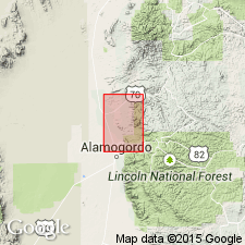
Pg. 25-26. Bursum formation. In northern Sacramento Mountains, Thompson's sequence of "transition beds" consists largely of marine sequences of fossiliferous gray shale, limestone, and sandstone, whereas in central New Mexico the Bursum is predominantly red beds that occur interbedded with a few thin fusulinid-bearing limestones. In addition, upper part of "transition beds" occurring north of Tularosa are younger than "Bursum" age. Name Laborcita formation is therefore proposed for strata between top of Holder formation and top of highest marine limestone underlying main mass of Abo red beds.
Source: US geologic names lexicon (USGS Bull. 1200, p. 552-553).
- Usage in publication:
-
- Bursum Formation*
- Modifications:
-
- Revised
- AAPG geologic province:
-
- Estancia basin
- San Juan basin
Summary:
Pg. F11-F12. Bursum Formation of Madera Group. In southern part of Manzano Mountains, central New Mexico, reassigned to Madera Group as uppermost of its three formations; overlies Wild Cow Formation (new). In northern part of Manzano Mountains, equivalent rocks not separately mappable are included in La Casa Member of Wild Cow Formation. Bursum remains uppermost formation of Magdalena Group elsewhere. Consists of a sequence of lenticular red, arkosic, hematitic sandstone, red and locally green shale, and greenish-gray calcarenite. Top of Bursum placed at top of highest marine limestone that underlies Abo Formation. Thickness 100+ feet. Fossils, includes fusulinid SCHWAGERINA PINOSENSIS Thompson, 1954. Age is Early Permian (Wolfcampian).
Source: Publication; Changes in stratigraphic nomenclature, 1973 (USGS Bull. 1395-A, p. A8-A9).
- Usage in publication:
-
- Bursum Formation*
- Modifications:
-
- Biostratigraphic dating
- AAPG geologic province:
-
- Orogrande basin
Myers, D.A., 1988, Stratigraphic distribution of some fusulinids from the Wild Cow and Bursum Formations, Manzano Mountains, New Mexico: U.S. Geological Survey Professional Paper, 1446-B, p. 25-65.
Summary:
Pg. 33-34, pls. Bursum Formation of Madera Group. Present only in southern part of Manzano Mountains. Exposures generally poor and no complete section was measured or described. Consists of about 250 feet of reddish-brown, arkosic, hematitic, cross-bedded, locally conglomeratic sandstone, red and gray shale, and olive-gray limestone. Is top formation of Madera Group. Gradationally overlies La Casa Member of Wild Cow Formation of Madera Group. Age is considered Early Permian (Wolfcampian). Lower part of formaiton lies in the fusulinid Foraminifera zone of TRITICITES, assemblage subzone T. CREEKENSIS, indicating early Wolfcampian. Middle part lies in the fusulinid Foraminifera zone of SCHWAGERINA. Fusulinids of the assemblage subzone T. CREEKENSIS occur in the Bird Spring Formation of Nevada, Pueblo Formation of central Texas, and Council Grove Group of Kansas.
Source: Publication.
- Usage in publication:
-
- Bursum Formation*
- Modifications:
-
- Mapped 1:24k
- AAPG geologic province:
-
- Orogrande basin
Summary:
Bursum Formation of Magdalena Group. Moderate-red, green, and purplish-gray shale and calcareous shale; minor red sandstone and gray limestone. Nodular, purplish-gray, argillaceous limestone at base and top of unit. Transitional from underlying marine to overlying continental sedimentary rocks. About 300 feet thick. Age is Early Permian.
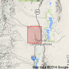
Mapped along Cuchillo Negro Creek in central part of quadrangle, Sierra Co., southwestern NM, Truth or Consequences area.
Source: Publication.
- Usage in publication:
-
- Bursum Formation
- Modifications:
-
- Revised
Kues, B.S., 2001, The Pennsylvanian System in New Mexico; Overview with suggestions for revisions of stratigraphic nomenclature: New Mexico Bureau of Geology and Mineral Resources, New Mexico Geology, v. 23, no. 4, p. 103-122.
Summary:
Pg. 106-107 (fig. 3, strat. chart). Bursum Formation of Madera Group. Included in Madera Group (except in Joyita Hills area, central New Mexico). Recognized in southwestern New Mexico (Sierra Oscura, Mud Springs, and northern San Andres Mountains) and in central New Mexico (Socorro area, Joyita Hills, and Los Pinos, Manzano, and Manzanita Mountains). Overlies Bar B Formation or Antrasado Formation of Madera Group, or Panther Seep Formation. Underlies Abo Formation or Hueco Formation. Is equivalent to Laborcita Formation of Sacramento Mountains, and partly equivalent to Red Tanks Formation of Madera Group in Lucero uplift. Age is Early Permian (Wolfcampian); locally, in Mud Springs Mountains, age is Late Pennsylvanian (late Virgilian) to Early Permian (Wolfcampian).
Source: Publication.
For more information, please contact Nancy Stamm, Geologic Names Committee Secretary.
Asterisk (*) indicates published by U.S. Geological Survey authors.
"No current usage" (†) implies that a name has been abandoned or has fallen into disuse. Former usage and, if known, replacement name given in parentheses ( ).
Slash (/) indicates name conflicts with nomenclatural guidelines (CSN, 1933; ACSN, 1961, 1970; NACSN, 1983, 2005, 2021). May be explained within brackets ([ ]).