The National Geologic Map Database is migrating to a new infrastructure. We apologize for any service disruptions during this process.
|
|---|


- Usage in publication:
-
- Burrows dolomite
- Modifications:
-
- Original reference
- AAPG geologic province:
-
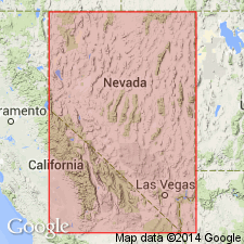
- Great Basin province
Summary:
Pg. 12, 27-29. Burrows dolomite. Name applied to variable thickness of strata between Peasley limestone (new) and Highland Peak unit "C" of Wheeler and Lemmon (Nevada Univ. Bull., Geology and Mining Ser., no. 31, 1939); both contacts unconformable. Locally called "Davidson" dolomite. Consists mainly of a white and light, medium, to dark-gray, coarse-grained (sugary textured) massively bedded dolomite. Basal 29 feet (at type locality) are thinly and distinctly bedded, medium- and dark-gray, fine-grained limestone; beds vary in thickness from about 29 to 33 feet throughout district. Thickness ranges from 130 feet in Panaca Hills to about 400 feet at type section; 230 feet on southwest slope of Ely Range. [Age is Middle Cambrian.]
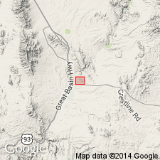
Type section: on northwest spur of Comet Peak, immediately south of Peasley [Peaslee] Canyon, on west slope of Highland Range, [Highland Peak 7.5-min quadrangle], Pioche district, Lincoln Co., southeastern NV. Named from Burrows Canyon east of Comet Mine, about 1 mi south of type section, [Highland Peak 7.5-min quadrangle].
[Comet Peak, Lat. 37 deg. 53 min. 45 sec. N., Long. 114 deg. 35 min. 09 sec. W. (USGS GNIS database, accessed February 13, 2016).]
Source: US geologic names lexicon (USGS Bull. 1200, p. 551-552); GNU records (USGS DDS-6; Menlo GNULEX).
- Usage in publication:
-
- Burrows limestone
- Modifications:
-
- Redefined
- Areal extent
- AAPG geologic province:
-
- Great Basin province
Summary:
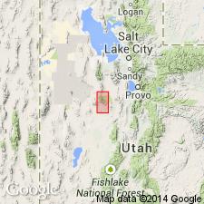
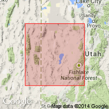
Pg. 36-38. Burrows limestone. Originally termed dolomite; studies now indicate unit is thickly to massively bedded light-colored limestone which has locally been subjected to epigenetic dolomitization. Underlies Burnt Canyon limestone (new). Geographically extended into House and Wah Wah Ranges, western Utah, where it consists of the light-gray zone, 340 [335] feet thick in middle part of the "Howell limestone" of Deiss (GSA Bull., v. 49, p. 1145, 1938). [Age is Middle Cambrian.]
Source: US geologic names lexicon (USGS Bull. 1200, p. 551-552).
- Usage in publication:
-
- Burrows limestone
- Modifications:
-
- Areal extent
- AAPG geologic province:
-
- Great Basin province
Wheeler, H.E., and Steele, Grant, 1951, Cambrian sequence of the House Range, Utah: Utah Geological Society, Guidebook to the geology of Utah, no. 6.
Summary:
Pg. 32 (fig. 5), 35. Burrows limestone. In House Range [central western Utah], underlies Burnt Canyon limestone and overlies Millard limestone. Thickness 340 feet. Age is Middle Cambrian.
Notable exposures in areas of: Groom, Pioche, Cherry Creek, and Eureka, NV; and Wah Wah and House Ranges, and Gold Hill, UT.
Source: Publication; US geologic names lexicon (USGS Bull. 1200, p. 551-552).
- Usage in publication:
-
- Burrows limestone*
- Modifications:
-
- Revised
- AAPG geologic province:
-
- Great Basin province
Summary:
Pg. 35, 44. Burrows limestone of Ophir group. Included in Ophir group in Sheeprock Mountains, western Utah, although not clearly recognized in area. On basis of grain size, basal 21 feet of Burnt Canyon limestone may represent the Burrows. No unconformity was noted at or near base of Burnt Canyon lithology, but it is possible one may be present which could account for absence of Burrows lithology. [Age is Middle Cambrian.]
Source: US geologic names lexicon (USGS Bull. 1200, p. 551-552).
- Usage in publication:
-
- Burrows limestone
- Modifications:
-
- Revised
- Areal extent
- AAPG geologic province:
-
- Great Basin province
Summary:
Pg. 50. [Burrows limestone. Revision of Wheeler's (1948) classification. Burrows limestone is geographically restricted to its type area, Pioche district, southeastern Nevada. Underlies Whirlwind formation (new); overlies Peasley formation. Stratigraphically extended upward to include basal part of Wheeler's Burnt Canyon limestone (discontinued). Thickness not given. Age is considered Middle Cambrian (BATHYURISCUS-ELRATHINA trilobite assemblage zone). Strata of Wheeler's Burrows limestone in House Range, central western Utah, and Wah Wah Range, southern western Utah, are transferred to Howell limestone and Dome limestone, respectively.]
Wheeler's correlation of middle unit of Howell limestone with Burrows limestone of Pioche district is here considered inaccurate because "Burrows limestone" in House Range underlies Chisholm formation, whereas in Pioche district, the Burrows limestone overlies both Chisholm and Peasley formations. Consequently, because the two units are not correlative, the "Burrows limestone" of House Range is without a valid name. It is proposed here that the definition of Howell limestone (citing Walcott, 1908a, 1908b, and Deiss, 1938) be further restricted to include only the carbonate sequence of western Utah that underlies Chisholm formation and overlies Busby and Tatow formations, or their equivalents, and that Millard limestone be reduced in rank to member of the Howell.
Source: Publication; US geologic names lexicon (USGS Bull. 1200, p. 551-552).
- Usage in publication:
-
- Burrows Member*
- Modifications:
-
- Revised
- Adopted
- AAPG geologic province:
-
- Great Basin province
Summary:
Pg. 34 (table 5), 36-41. Burrows Member of Highland Peak Formation. At type section is chiefly dolomite, about 370 feet thick. Is restricted from Burrows Dolomite of Wheeler (1940) to exclude lowermost 30 feet of limestone (transferred to underlying Peasley Member); is = Highland Peak "B" of Wheeler and Lemmon (1939) and "Gray Davidson dolomite" of mining companies. At places it changes to limestone, hence term "member" is more appropriate than a lithologic modifier. Common features of the limestone facies are irregular white calcitic inclusions, "bluebird structure" (after Bluebird Dolomite wherein these peculiar structures were first described). Lies between Peasley and Burnt Canyon Members of Highland Peak Formation. Probably correlates with Dome Limestone of House Range, [central western Utah]. Fossils, undiagnostic algal nodules GIRVANELLA. Age is considered Middle Cambrian, based on stratigraphic position.
[Burows Member of Highland Peak Formation, as recognized in Pioche district, Lincoln Co., NV, adopted by the USGS (GNC index card files, USGS-Menlo, USGS-Reston; GNC changes in geologic nomenclature, unpub., Jan. 1, 1962-June 30, 1962, p. 13).]
Source: Publication; GNU records (USGS DDS-6; Menlo GNULEX); GNC index card files (USGS-Menlo; USGS-Reston).
For more information, please contact Nancy Stamm, Geologic Names Committee Secretary.
Asterisk (*) indicates published by U.S. Geological Survey authors.
"No current usage" (†) implies that a name has been abandoned or has fallen into disuse. Former usage and, if known, replacement name given in parentheses ( ).
Slash (/) indicates name conflicts with nomenclatural guidelines (CSN, 1933; ACSN, 1961, 1970; NACSN, 1983, 2005, 2021). May be explained within brackets ([ ]).