The National Geologic Map Database is migrating to a new infrastructure. We apologize for any service disruptions during this process.
|
|---|


- Usage in publication:
-
- Burro gravels and tuffs
- Modifications:
-
- Original reference
- Dominant lithology:
-
- Gravel
- Breccia
- Sandstone
- Tuff
- AAPG geologic province:
-
- Permian basin
Summary:
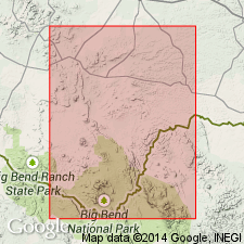
Pg. 17, 67. Burro gravels and tuffs. Regularly bedded gravels, breccias, sandstones, and yellow and red tuffs, with a well-worn conglomerate at one locality. Directly underlie lava flows that cap Burro Mesa, and some of deposits apparently are interbedded with the lava. Unconformably overlie Crown conglomerate. Tentatively assigned to Tertiary.
[Named from Burro Mesa, Brewster Co., western TX.]
Source: US geologic names lexicon (USGS Bull. 896, p. 302).
For more information, please contact Nancy Stamm, Geologic Names Committee Secretary.
Asterisk (*) indicates published by U.S. Geological Survey authors.
"No current usage" (†) implies that a name has been abandoned or has fallen into disuse. Former usage and, if known, replacement name given in parentheses ( ).
Slash (/) indicates name conflicts with nomenclatural guidelines (CSN, 1933; ACSN, 1961, 1970; NACSN, 1983, 2005, 2021). May be explained within brackets ([ ]).