

- Usage in publication:
-
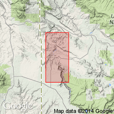
- Burro Canyon formation*
- Modifications:
-
- Named
- Dominant lithology:
-
- Conglomerate
- Sandstone
- Shale
- Limestone
- Chert
- AAPG geologic province:
-
- Paradox basin
Summary:
Named for Burro Canyon, east of the Dolores River, San Miguel Co, CO in the Paradox basin. Type locality designated as in sec 29, T44N, R18W, San Miguel Co in Paradox basin. Consists of alternating gray, yellow, brown, and green conglomerate and sandstone and varicolored shale, limestone, and chert. Ranges from 150 to 260 ft thick. Lower contact placed at base of lowest resistant, light-colored conglomeratic sandstone above Brushy Basin member of Morrison formation; upper contact with Dakota sandstone placed above highest varicolored beds thereby excluding from the Burro Canyon any carbonaceous shales or sandstones in which plant fragments are common. Assignment to Early Cretaceous? based on stratigraphic position and similarity with rocks of Early Cretaceous age in surrounding regions.
Source: GNU records (USGS DDS-6; Denver GNULEX).
- Usage in publication:
-
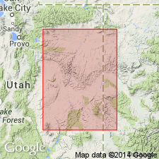
- Burro Canyon formation
- Modifications:
-
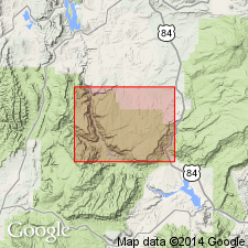
- Areal extent
- Overview
- AAPG geologic province:
-
- Paradox basin
Summary:
Used east of the Colorado River in southeast UT and southwest CO, generally in the Paradox basin. Is generally equivalent to Cedar Mountain formation. The two formations are in physical continuity near Dewey, Grand CO., UT. Is a nonmarine unit of Early Cretaceous age. Contains fresh-water ostracods, plant fragments, and fish scale fossils.
Source: GNU records (USGS DDS-6; Denver GNULEX).
- Usage in publication:
-
- Burro Canyon formation*
- Modifications:
-
- Revised
- AAPG geologic province:
-
- Paradox basin
Summary:
Is a green mudstone interbedded with lenses of conglomerate and conglomeratic sandstone. The lowest conglomerate is part of a system of shoestring channel-filling lenses named Karla Kay conglomerate member. Number of conglomerate lenses decreases southward toward Four Corners. Mudstones of Burro Canyon and underlying Brushy Basin Member of Morrison formation distinguishable by weathering character. Those of Burro Canyon have hackly surface. Those of Brush Basin have frothy appearing crust. Complete section 206 ft thick of Burro Canyon measured at Tozer Gulch, McElmo Canyon, sec 30, T36N, R18W, Montezuma Co, CO. Formation described as having a 64 ft basal conglomerate and sandstone overlain by gray to pale-green and red mudstone, gray to white, fine-grained sandstone. Unconformably underlies Dakota sandstone. Brushy Basin and Burro Canyon are conformable and intertongue. New member probably equivalent to Buckhorn member of Cedar Mountain formation shows new sedimentary cycle initiated by uplift west of Four Corners area. Early Cretaceous age. Cross section.
Source: GNU records (USGS DDS-6; Denver GNULEX).
- Usage in publication:
-
- Burro Canyon Formation*
- Modifications:
-
- Overview
- AAPG geologic province:
-
- Paradox basin
- Piceance basin
- San Juan basin
Summary:
Is a fluvial and overbank deposit of the Paradox basin, Piceance basin, and San Juan basin. Has dinosaur, plant, algae, freshwater gastropods, pelecypods, and ostracod fossils. Palynomorphs near top of formation indicate a middle to late Early Cretaceous (Aptian-early Aptian) age and an Early Cretaceous (possibly Barremian) age. Is equivalent to Cedar Mountain Formation west of Colorado River.
Source: GNU records (USGS DDS-6; Denver GNULEX).
- Usage in publication:
-
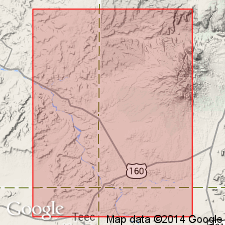
- Burro Canyon? Formation*
- Modifications:
-
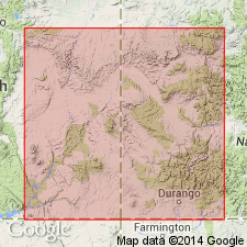
- Areal extent
- AAPG geologic province:
-
- San Juan basin
Summary:
Lithology (conglomerate, sandstone, and red, green to purple mudstone) and stratigraphic position (unconformably above Upper Jurassic Morrison Formation and unconformably below Upper Cretaceous Dakota Sandstone) suggest correlation with Burro Canyon Formation, but no direct correlation can be made from this area, the Chama basin of the eastern San Juan basin into the Paradox basin and Piceance basin. Is 57 to 176 ft thick. Variation in thickness attributed to relief on erosion surface beneath formation. Of Early Cretaceous age.
Source: GNU records (USGS DDS-6; Denver GNULEX).
- Usage in publication:
-
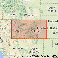
- Burro Canyon Formation*
- Modifications:
-
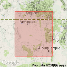
- Areal extent
- Overview
- Biostratigraphic dating
- AAPG geologic province:
-
- Paradox basin
- San Juan basin
- Piceance basin
- Eagle basin
Summary:
Is distinguished from the underlying Brushy Basin Member of the Morrison Formation by presence of coarse, generally conglomeratic sandstone and interbedded dominantly greenish-gray mudstone composed of nonswelling clay whereas the Brushy Basin has few conglomeratic sandstone beds, contains swelling clay, and forms distinct color-banded outcrops. Is distinguished from overlying Dakota Sandstone by presence of greenish mudstone and absence of carbonaceous material, and organic-rich shale, lignite, or coal. Collections of palynomorphs from two shale units in upper part of Burro Canyon are Aptian to early Albian age, and may possibly be late Barremian age. Though most agree Cedar Mountain Formation and Burro Canyon are physically continuous, palynomorphs indicate that the upper part of Burro Canyon is older than the Cedar Mountain. It is suggested that some of the upper Burro Canyon may have been eroded. Areal extent map indicates presence in San Juan, Paradox, and Piceance basins of UT and CO and possibly Eagle basin. Faunal listings. Graphic sections.
Source: GNU records (USGS DDS-6; Denver GNULEX).
- Usage in publication:
-
- Burro Canyon Formation*
- Modifications:
-
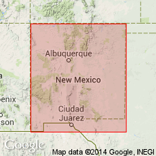
- Revised
- AAPG geologic province:
-
- San Juan basin
Summary:
Unconformably underlies the newly named Encinal Canyon Member of Dakota Sandstone north of Regina, Sandoval Co, NM to Mesa Laguna, sec 10, T24N, R2E, Rio Arriba Co, on east side of San Juan basin, NM. Of Early Cretaceous age.
Source: GNU records (USGS DDS-6; Denver GNULEX).
- Usage in publication:
-
- Burro Canyon? Formation*
- Modifications:
-
- Overview
- AAPG geologic province:
-
- San Juan basin
Summary:
In northeast San Juan basin (Chama basin) is tentatively correlated with Jackpile Sandstone Member of Morrison Formation on western margin of Nacimiento uplift, San Juan basin. Correlation based on similar lithologies, fluvial characteristics, paleocurrent directions and interfingering relationships with underlying Brushy Basin Member of Morrison. Though Burro Canyon? and Jackpile occupy same stratigraphic position between underlying Brushy Basin and overlying Dakota Sandstone, their stratigraphic relationship is uncertain. Burro Canyon? and Jackpile interval probably represents single, depositionally continuous fluvial unit. Measured sections on eastern side of San Juan basin show no evidence of major break or unconformity below either Burro Canyon? or Jackpile; however, local scouring, typical of fluvial sandstones, does occur. Bases of Burro Canyon? and Jackpile probably locally grade into underlying Brushy Basin suggesting conformable relationship. Burro Canyon? considered late Early Cretaceous age if it actually correlates with type Burro Canyon in southwest CO; however, no age-diagnostic fossils have been reported from either Burro Canyon? or Jackpile in San Juan basin.
Source: GNU records (USGS DDS-6; Denver GNULEX).
For more information, please contact Nancy Stamm, Geologic Names Committee Secretary.
Asterisk (*) indicates published by U.S. Geological Survey authors.
"No current usage" (†) implies that a name has been abandoned or has fallen into disuse. Former usage and, if known, replacement name given in parentheses ( ).
Slash (/) indicates name conflicts with nomenclatural guidelines (CSN, 1933; ACSN, 1961, 1970; NACSN, 1983, 2005, 2021). May be explained within brackets ([ ]).