- Usage in publication:
-
- Burrego formation
- Modifications:
-
- Named
- Dominant lithology:
-
- Limestone
- Sandstone
- Shale
- AAPG geologic province:
-
- Orogrande basin
Summary:
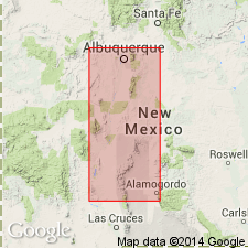
Named as lowest of two formations of Hansonburg group (new) of Missouri series for Burrego Spring on northeast side Oscura Mountains, NM. Type locality is section measured in and near east portion of SE1/4 sec 31, T5S, R6E, northeast side of Oscura Mountains, Socorro Co, NM. Overlies Council Spring limestone of Veredas group (both new); underlies Story formation (new) of Hansonburg. Consists of massive to massively bedded and nodular limestones; at type is almost entirely limestone, but in area of Mocking Bird Gap contains numerous thick sandstones, and on Cadronito Hill contains several thick shale strata. Most of the limestones at type are gray to light gray in color. However, some of the thin limestone beds are brilliantly colored, from purple to orange, and are traceable over wide areas. In northern part of Oscura Mountains is 52 ft thick. Is considerably thicker in region of Mocking Bird Gap to south of type locality, and in region of Ladron Mountains and Cadronito Hill northwest of type locality. Fauna is very large and varied, but megafauna not studied in detail. Highly varied fusulinid faunas are abundant in numerous strata throughout unit. Many of Burrego fusulinid species are recognized over large areas in NM--but apparently most are confined to Burrego. All are referable to genus TRITICITES. Is of Pennsylvanian (Missouri) age.
Source: GNU records (USGS DDS-6; Denver GNULEX).
For more information, please contact Nancy Stamm, Geologic Names Committee Secretary.
Asterisk (*) indicates published by U.S. Geological Survey authors.
"No current usage" (†) implies that a name has been abandoned or has fallen into disuse. Former usage and, if known, replacement name given in parentheses ( ).
Slash (/) indicates name conflicts with nomenclatural guidelines (CSN, 1933; ACSN, 1961, 1970; NACSN, 1983, 2005, 2021). May be explained within brackets ([ ]).

