- Usage in publication:
-
- Burr limestone member
- Modifications:
-
- Original reference
- Dominant lithology:
-
- Shale
- Limestone
- AAPG geologic province:
-
- Nemaha anticline
- Salina basin
- Cherokee basin
- Forest City basin
Summary:
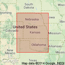
Burr limestone member of Grenola formation. The newly established Grenola formation is divided into following members (descending): Neva limestone, Salem Point shale, Burr limestone, Legion shale, and Sallyards limestone. The salient lithologic feature of Burr member is its lamination. It is calcareous throughout and has a carbonaceous shale in the middle to north. Is of nearshore marine origin. Averages about 11 feet in thickness from Roca, [Lancaster County], Nebraska, to Burbank, [Osage County], Oklahoma, disregarding the abnormal Pawnee County, Nebraska, section. The upper Burr in Nebraska is light gray, with an extremely dense, carbonaceous lime cap that covers an ostracodal zone. The middle Burr in Nebraska, and northern Kansas is black or brownish shale containing abundant plant remains. The lower Burr in Nebraska consists of 1, 2, or 3 limestones separated by shale, and farther south it is irregular, shaly, and nodular with dark-gray mottling, and weathers platy or shattered.
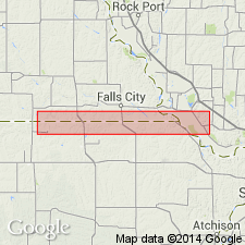
Type locality: the bluffs and ravines west of South Fork of Little Nemaha River, in sec. 20, at point 0.25 mi west of north-south road, 2.5 mi northwest of Burr, Otoe Co., NE.
Source: US geologic names lexicon (USGS Bull. 896, p. 302).

- Usage in publication:
-
- Burr limestone member
- Modifications:
-
- Revised
- AAPG geologic province:
-
- Forest City basin
Summary:
Pg. 8. Burr limestone member of Grenola formation of Council Grove group. Consists of (descending): (1) gray massive limestone, 3.5 to 4 feet; (2) gray and black shale, 3.5 feet; (3) light gray massive limestone, 1.5 to 3.5 feet. Thickness 10 to 11 feet. Overlies Legion shale member and underlies Salem Point shale member. Condra states that the Kansas Geol. Survey correlates Legion shale and underlying Sallyards limestone with Roca shale formation. Age is considered Permian (lower part of Big Blue).
In 1936 (Kansas Geol. Survey Bull., no. 22) R.C. Moore transferred Roca shale to Permian. This change in Permian-Pennsylvanian boundary has not been considered [ca. 1938] by the USGS for its publications.
Source: Publication; US geologic names lexicon (USGS Bull. 896, Roca entry p. 1823); GNC KS-NE Pennsylvanian Corr. Chart, sheet 2, Oct. 1936.

- Usage in publication:
-
- Burr limestone member
- Modifications:
-
- Revised
Summary:
Burr limestone member, basal member of Grenola formation in lower part of Council Grove group. Transferred this unit to Permian (Big Blue series).
[This change in Pennsylvanian-Permian boundary has not been considered by USGS for it publications [ca. 1938].
See "Modern classifications of the Pennsylvanian rocks of eastern Kansas and southeastern Nebraska," compiled by M.G. Wilmarth, Secretary of Committee on Geologic Names, USGS unpub. corr. chart, Oct. 1936, sheet 2.]
Source: US geologic names lexicon (USGS Bull. 896, p. 302); GNC KS-NE Pennsylvanian Corr. Chart, sheet 2, Oct. 1936.

- Usage in publication:
-
- Burr limestone member
- Modifications:
-
- Overview
Summary:
Pg. 48. Burr limestone member of Grenola limestone. Underlies Salem Point shale member [and] overlies Legion shale member, [both of Grenola limestone]. Thickness 8 to 15 feet. Age is Early Permian (Wolfcamp).
Source: US geologic names lexicon (USGS Bull. 1200, p. 548).

- Usage in publication:
-
- Burr Limestone Member
- Modifications:
-
- Overview
Summary:
(Paleozoic Era; Permian System by H.G. O'Connor, D.E. Zeller, C.K. Bayne, J.M Jewett, and Ada Swineford, p. 46.) Burr Limestone Member of Grenola Limestone of Council Grove Group. Fossiliferous gray limestone and gray to olive-gray shale. In Chase County, Kansas, the middle limestone beds are very fine-grained and platy. Ostracodes are abundant in some of the limestones. Mollusks and other fossils are abundant locally in the lower beds. Thickness 1 to 15 feet. Age is Early Permian; Gearyan Provincial Stage (of H.G. O'Connor, 1963, AAPG Bull., v. 47, p. 1873-1877).
Source: Publication.
For more information, please contact Nancy Stamm, Geologic Names Committee Secretary.
Asterisk (*) indicates published by U.S. Geological Survey authors.
"No current usage" (†) implies that a name has been abandoned or has fallen into disuse. Former usage and, if known, replacement name given in parentheses ( ).
Slash (/) indicates name conflicts with nomenclatural guidelines (CSN, 1933; ACSN, 1961, 1970; NACSN, 1983, 2005, 2021). May be explained within brackets ([ ]).

