The National Geologic Map Database is migrating to a new infrastructure. We apologize for any service disruptions during this process.
|
|---|


- Usage in publication:
-
- Burnt River schist*
- Modifications:
-
- Original reference
- Dominant lithology:
-
- Schist
- AAPG geologic province:
-
- Snake River basin
Summary:
Burnt River schist. Various greenstone schists, quartz schist, conglomeratic schist, and some interbedded limestone, slate, and quartzite. Thickness 5,000+ feet. Tentatively assigned to pre-Carboniferous(?). May possibly be Triassic or younger, but believed to be older than Clover Creek greenstone (Permian) and older than Elkhorn Ridge argillite (Pennsylvanian?).
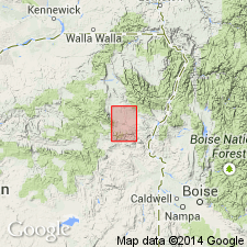
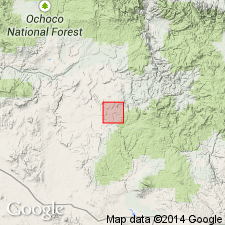
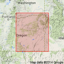
Named from exposures in canyon of Burnt River, in T. 11 and 12 S., R. 41 E., Baker quadrangle, Baker Co., northeastern OR.
Source: US geologic names lexicon (USGS Bull. 896, p. 301).
- Usage in publication:
-
- Burnt River schist*
- Modifications:
-
- Areal extent
Summary:
Pg. 162-163. Discussion of late Paleozoic formations of central Oregon. Burnt River schist in eastern Oregon shows very little similarity to any of the formations under discussion (Coffee Creek, Spotted Ridge, and Coyote Butte) beyond occurrence of limestone and conglomerate. Indefinite age.
Source: US geologic names lexicon (USGS Bull. 1200, p. 547).
- Usage in publication:
-
- Burnt River Schist
- Modifications:
-
- Overview
Summary:
Pg. 7. Burnt River Schist. Defined by Gilluly (1937) who designated exposures in Burnt River Canyon in southern part of the Baker 30- by 60-min quadrangle (T. 11 and 12 S., R. 41 E.) as the type locality. Strata continuous with Burnt River Schist are fairly widespread in southern part of Baker County, but precise nature and distribution of unit is poorly understood. Parts of Burnt River Schist are correlative with part of "argillite series" of Pardee (1941) in Sumpter quadrangle and part of pre-Tertiary "greenschist," Nelson Marble, and "gray phyllite" of Prostka (1967) in Durkee quadrangle. Wolff (1965) reports the unit to the south in Ironside Mountain quadrangle.
Consists of a minimum of several thousand feet of quartzitic and pelitic phyllitic rocks, metavolcaniclastic rocks, greenstones, and minor marble. Parent rocks are interpreted to have been flows and tuffs of basalt and andesite, beds of volcanic sandstone, chert, shale, and limestone. Collectively the rocks correspond to those making up present-day deep-sea floor. According to Ashley (1966) northern half of exposure of Burnt River Schist along Burnt River consists primarily of phyllitic rocks which include quartz phyllites, phyllitic quartzites, and minor pelitic phyllite. Other rock types include andesitic and dacitic pyroclastic material, minor flows of greenstone, and some marble. To the south major rock types include metabasalts, meta-andesites, pelitic phyllites, and marble.
An east-west fault separates northern exposures from southern exposures and straddles east-flowing segment of the Burnt River, approx. midway between Bridgeport and Durkee Valley. Two sets of steeply dipping shear planes impart prominent east-west lineation to unit. Structural geometry in type area has been studied in detail by Ashley (1966), and Wolff (1965) discusses possible isoclinal folding and repetition of the section in Ironside Mountain quadrangle to the south. In view of plate tectonics model, the Burnt River Schist may represent several inclined slabs of sea floor structurally stacked one atop the other in a late Paleozoic subduction zone.
Relationship of Burnt River Schist to other units of similar age is poorly understood owing to similar lithologies, complex structures, and varying degrees of deformation. The widespread relatively high degree of deformation in the Burnt River Schist suggests to some that it predates the Elkhorn Ridge Argillite. Alternatively, the two units may have been deposited contemporaneously and subsequently may have occupied different positions in a regionally variable tectonic setting. No diagnostic fossils have been recovered. Age is late Paleozoic, possibly Permian, based on metamorphic grade.
See also:
Ashley, R.P., 1966 [1967?], Stanford Univ. unpub. PhD thesis, 193 p. (Metamorphic petrology and structure of Burnt River Canyon area, northeastern OR).
Pardee, J.T., 1941, Oregon Dept. Geol. and Min. Ind. Map. (Sumpter quadrangle).
Prostka, H.J., 1967, Oregon Dept. Geol. and Min. Ind. Map, GMS-3, scale 1:62,500 (Durkee quadrangle).
Wolff, E.N., 1965, Univ. Oregon unpub. PhD thesis, 200 p. (Geol. of northern half of Caviness quadrangle, OR). [See also E.N. Wolff, 1965, "Tentative Tertiary stratigraphy and structure of the northern part of Caviness quadrangle, Malheur and Baker Counties, eastern Oregon," GSA Special Paper 82, 352 p.]
Source: Publication.
For more information, please contact Nancy Stamm, Geologic Names Committee Secretary.
Asterisk (*) indicates published by U.S. Geological Survey authors.
"No current usage" (†) implies that a name has been abandoned or has fallen into disuse. Former usage and, if known, replacement name given in parentheses ( ).
Slash (/) indicates name conflicts with nomenclatural guidelines (CSN, 1933; ACSN, 1961, 1970; NACSN, 1983, 2005, 2021). May be explained within brackets ([ ]).