

- Usage in publication:
-
- Burnt Gulch conglomerate
- Burnt Gulch formation
- Modifications:
-
- Original reference
- Dominant lithology:
-
- Conglomerate
- AAPG geologic province:
-
- Wind River basin
Summary:
Pg. 124 (table 1), 143, fig. 2. Burnt Gulch conglomerate and Burnt Gulch formation. Alluvian fan remnants. Made up in the main of boulders, gravel, and sand almost without stratification; poorly cemented at most places. Boulders more than 20 feet in diameter have been measured, but they decrease in size away from mountains. Near the mountains, they are schist and granodiorite. Thickness on Dinwoody Creek 300 feet. Younger than White River formation. Age is Miocene or Pliocene [according to GNU records (USGS DDS-6; Denver GNULEX, Sept. 10, 1992), authors assigned a Pliocene age to this unit].
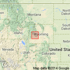
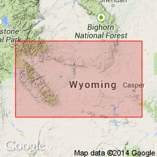
Type locality: at west end of Table Mountain on Burnt Gulch, [in vicinity of Lat. 42 deg. 41 min. 56 sec. N., Long. 108 deg. 51 min. 24 sec. W., Fossil Hill 7.5-min quadrangle, Shoshone National Forest, Fremont Co., northeastern WY]. Present along east slope of Wind River Mountains, Fremont Co., northwestern WY. Best exposures on Dinwoody Creek. Named from Burnt Gulch. [Lat/Long coords. from USGS GNIS database and ACME Mapper 2.0, accessed February 20, 2009.]
Source: US geologic names lexicon (USGS Bull. 1200, p. 546-547); supplemental information from GNU records (USGS DDS-6; Denver GNULEX).
- Usage in publication:
-
- Burnt Gulch Formation
- Modifications:
-
- Overview
- AAPG geologic province:
-
- Wind River basin
Summary:
Is a boulder conglomerate of deeply weathered granitoid clasts in an arkose matrix. Some of the arkose units are lenticular, some are well sorted and cross-bedded. Preserved locally in upper part of major valleys on northeast flank of Wind River Mountains for a distance of 70 mi between Jakeys Fork Canyon near Dubois and Table Mountain near Lander, Fremont Co., WY in the Wind River basin. Many have considered Burnt Gulch to be the conglomerate facies of the Wind River Formation, but it is very different from other conglomeratic, non-volcanic units in the region. Authors of this paper consider Burnt Gulch to be a Pleistocene or late Pliocene age unit. Categorized as an epiclastic, extra formational, paraconglomerate composed of 88+% of deeply weathered, friable, randomly arranged, well rounded clasts of Precambrian granitoid igneous and meta-igneous clasts whose maximum size is 23 ft. Fifty percent of the clasts are 9+ inches in diameter. More than 50 % of the clasts are deeply weathered. Also includes fragments of quartz arenite and arkose from the Flathead Formation. No relationship between clast size and position in formation. Stratigraphic table. Columnar section. Individual localities described. Maximum measured thickness is 779 ft. Originally estimated at 1,720 ft thick. Thought to have been an alluvial fan debris flow resulting from a change in climate and tectonic conditions. The flow accumulated in valleys cut into Wind River Mountains between late Pliocene and pre-late Illinoian time, prior to alpine glaciation. Overlies Paleozoic, Mesozoic, or Cenozoic rocks and is overlain by Quaternary glacial drift.
Source: GNU records (USGS DDS-6; Denver GNULEX).
For more information, please contact Nancy Stamm, Geologic Names Committee Secretary.
Asterisk (*) indicates published by U.S. Geological Survey authors.
"No current usage" (†) implies that a name has been abandoned or has fallen into disuse. Former usage and, if known, replacement name given in parentheses ( ).
Slash (/) indicates name conflicts with nomenclatural guidelines (CSN, 1933; ACSN, 1961, 1970; NACSN, 1983, 2005, 2021). May be explained within brackets ([ ]).