

- Usage in publication:
-
- Burls Creek shale member
- Modifications:
-
- Original reference
- Biostratigraphic dating
- Dominant lithology:
-
- Shale
- Sandstone
- AAPG geologic province:
-
- Alaska Southern region
Summary:
Pg. 772-775, 779. Burls Creek shale member of Katalla formation. Upper member of Katalla formation as here restricted. Conformably overlies Split Creek shale and sandstone member. Best exposed on Burls Creek, Controller Bay region, southeastern Alaska. Consists of 3 conformable divisions (descending): (1) 1,700 feet of dark bluish-gray to almost black platy shale containing numerous round concretions and lenses of dense blue-gray limestone; (2) 300 to 500 feet of glauconitic sandstone (the organic shale horizon, which is made up of highly organic shales, often containing numerous grains of glauconite and several thick glauconitic sandstones); (3) 700 feet of dark platy shale, sometimes organic, with occasional thin layers of hard, tightly cemented, fine-grained sandstones, the shale containing some limestone concretions. Correlated with fossiliferous beds in Yakataga district that are assigned to upper Oligocene by B.L. Clark. This member is also exposed in Nichawak district.
[GNC remark (ca. 1936, US geologic names lexicon, USGS Bull. 896, p. 299): The USGS classifies typical Katalla formation as Miocene(?).]
Source: US geologic names lexicon (USGS Bull. 896, p. 299).
- Usage in publication:
-
- Burls Creek shale member*
- Modifications:
-
- Adopted
- Revised
- AAPG geologic province:
-
- Alaska Southern region
Summary:
Pg. 7 (table), 10-11, geol. map. Burls Creek shale member of Katalla formation. Restricted to massive gray shale and associated glauconitic sandstone that lie conformably between the Basin Creek (new) and organic shale members. Lower contact drawn at base of lowest bed of massive glauconitic sandstone or at top of highest bed of gray sandstone of Basin Creek type. Partly sandy shale forms major part of member except near head of east fork of Burls Creek and along Burls Creek-Chilkat Creek ridge, where total thickness of glauconitic sandstone beds nearly equals thickness of shale. Lens-shaped calcareous concretions, averaging more than 2 feet across, abundant in shale. Lithology and thickness range widely in Katana area. Thickness between 160 and 260 feet near head of west fork of Burls Creek ; increases to maximum of perhaps 1,000 feet in western part of area. Oil company geologists (unpub. mss.) have used term Burls Creek formation to include Basin Creek sandstone and shale below and Cannon-ball shale above.
Source: US geologic names lexicon (USGS Bull. 1200, p. 543).
- Usage in publication:
-
- Burls Creek shale member*
- Modifications:
-
- Mapped
- Dominant lithology:
-
- Shale
- Sandstone
- AAPG geologic province:
-
- Alaska Southern region
Summary:
Pg. 23 (table 1), 30-33, pls. Burls Creek shale member of Katalla formation [= classification of Miller and others, 1945, USGS OF-45-103]. Massive gray shale and associated glauconitic sandstone, tuff, and volcanic breccia lying conformably between Basin Creek and organic shale members of the Katalla. Thickness 150 to 1,000 feet. Tentatively correlated with Poul Creek formation of adjacent Yakataga district and Lincoln age rocks of Oregon and Washington. Age is considered Oligocene.
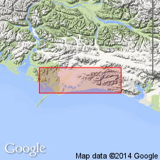
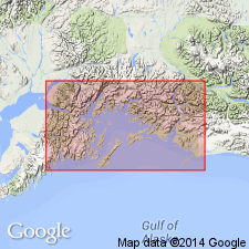
Recognized in Katalla area, Controller Bay region, southeastern AK.
Source: Publication.
- Usage in publication:
-
- Burls Creek Shale Member*
- Modifications:
-
- Principal reference
- Revised
- Dominant lithology:
-
- Shale
- Sandstone
- AAPG geologic province:
-
- Alaska Southern region
Summary:
Burls Creek Shale Member of Katalla Formation. Uppermost member of Katalla. Subdivided into (descending): (1) upper unit, interbedded shale and sandstone, 480 to 2,000 feet thick, =lower part of †Point Hey Member (abandoned) of Miller and others (1945); (2) organic shale unit, 50 to 200 feet thick, =organic shale member of Miller and others (1945); and (3) lower unit, mostly concretionary siltstone with varable amounts of glauconitic sandstone and fragmental volcanic rocks, 160 to 1,000+ feet thick, =Burls Creek Member of Miller and others (1945). Underlies Redwood Formation; overlies Basin Creek Member of Katalla Formation. Stratigraphically restricted from Burls Creek of Taliaferro (1932). Fossils. Age is late(?) Oligocene.
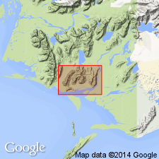
Type locality: divide between west fork of Burls Creek and east fork of Redwood Creek, Katalla district, Controller Bay region, southeastern AK.
Source: Publication; GNU records (USGS DDS-6; Menlo GNULEX).
- Usage in publication:
-
- Burls Creek Shale Member*
- Modifications:
-
- Revised
- AAPG geologic province:
-
- Alaska Southern region
Summary:
Burls Creek Shale member reassigned to Poul Creek Formation due to abandonment of Katalla Formation in favor of Poul Creek Formation. [Age remains late(?) Oligocene.]
Source: GNU records (USGS DDS-6; Menlo GNULEX).
For more information, please contact Nancy Stamm, Geologic Names Committee Secretary.
Asterisk (*) indicates published by U.S. Geological Survey authors.
"No current usage" (†) implies that a name has been abandoned or has fallen into disuse. Former usage and, if known, replacement name given in parentheses ( ).
Slash (/) indicates name conflicts with nomenclatural guidelines (CSN, 1933; ACSN, 1961, 1970; NACSN, 1983, 2005, 2021). May be explained within brackets ([ ]).