

- Usage in publication:
-
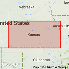
- Burlingame shale
- Modifications:
-
- Original reference
- Dominant lithology:
-
- Shale
- Sandstone
- AAPG geologic province:
-
- Forest City basin
Summary:
Pg. 278, and pl. 20; Amer. Jour. Sci., 3rd ser., v. 50, p. 461 and pl. opp. p. 466. Burlingame shale. Shales, with considerable sandstone, 150 feet thick, separated from underlying Osage coal by a thin but persistent limestone. Recognized in eastern Kansas and northwestern Missouri. Age is Pennsylvanian.
Named from Burlingame, Osage Co., eastern KS.
Source: US geologic names lexicon (USGS Bull. 896, p. 298).

- Usage in publication:
-
- Burlingame shale†
- Modifications:
-
- Abandoned
- AAPG geologic province:
-
- Forest City basin
Summary:
†Burlingame shale. Replaced with Scranton shale.
Source: US geologic names lexicon (USGS Bull. 896, p. 298).
For more information, please contact Nancy Stamm, Geologic Names Committee Secretary.
Asterisk (*) indicates published by U.S. Geological Survey authors.
"No current usage" (†) implies that a name has been abandoned or has fallen into disuse. Former usage and, if known, replacement name given in parentheses ( ).
Slash (/) indicates name conflicts with nomenclatural guidelines (CSN, 1933; ACSN, 1961, 1970; NACSN, 1983, 2005, 2021). May be explained within brackets ([ ]).