- Usage in publication:
-
- Burditt formation
- Burditt chalk marl
- Burditt marl
- Modifications:
-
- Original reference
- Dominant lithology:
-
- Clay
Summary:
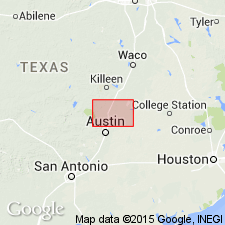
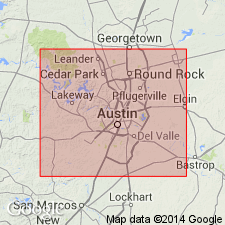
Pg. 239, 270, 407, 441, 442, 449. Burditt formation (p. 239), Burditt chalk marl (p. 407), Burditt marl (heading on p. 449). Hill included this chalk marl with Austin chalk, and stated that top is transitional to the Taylor. Taff segregated the upper marly lime zone of Austin chalk, and considered it lithologically transitional to Taylor marl. This chalk marl is here called Burditt, from Burditt School, Travis County, and type locality is along Little Walnut Creek downstream from Austin-Cameron Road, where the marl is 40+/- feet thick. It is a light-gray, somewhat shelly, calcareous clay overlying the hard chalk (Austin chalk proper). Stephenson states the Taylor in McLennan County unconformably overlies the Austin, and that its base contains a phosphatic pebble zone. There appears to be no marked break in Travis County, although a prominent layer of phosphatic nodules and fossils occurs in the Burditt near the type locality.
[GNC remark (ca. 1938, US geologic names lexicon, USGS Bull. 896, p. 295): According to L.W. Stephenson, 1937 (USGS Prof. Paper 186-G), the beds called Burditt Marl by Adkins are no more marly than other lower parts of Austin Chalk elsewhere in TX. If recognized as a separate lithologic unit it should be treated as an upper marly member of Austin Chalk.]
Source: US geologic names lexicon (USGS Bull. 896, p. 295).

- Usage in publication:
-
- Burditt marl
- Modifications:
-
- Biostratigraphic dating
- AAPG geologic province:
-
- Ouachita folded belt
Summary:
Pg. 477, 480 (fig. 2), 486-487. Burditt marl. Report is biostratigraphic study of Austin group in Williamson County, central Texas. Chart shows group comprises Austin chalk and Burditt marl. Thickness of Burditt 45 feet. Faunal change from Austin chalk to Burditt marl abrupt. Age is Late Cretaceous (Gulfian).
Source: US geologic names lexicon (USGS Bull. 1200, p. 536-537).

- Usage in publication:
-
- Burditt marl
- Modifications:
-
- Biostratigraphic dating
Summary:
Pg. 38+. Foraminifera described. Burditt marl listed in Austin group. [Age is Late Cretaceous (Gulfian).]
[Misprint (US geologic names lexicon (USGS Bull. 1200, p. 537): Report date cited as 1956. Should be 1954.]
Source: US geologic names lexicon (USGS Bull. 1200, p. 536-537).

- Usage in publication:
-
- Burditt marl
- Modifications:
-
- Contact revised
- AAPG geologic province:
-
- Ouachita folded belt
Summary:
[Pg. 57], pl. 16. Burditt marl. In Travis County, Texas, overlies Dessau formation (new). [Age is Late Cretaceous (Gulfian).]
Source: US geologic names lexicon (USGS Bull. 1200, p. 536-537).
For more information, please contact Nancy Stamm, Geologic Names Committee Secretary.
Asterisk (*) indicates published by U.S. Geological Survey authors.
"No current usage" (†) implies that a name has been abandoned or has fallen into disuse. Former usage and, if known, replacement name given in parentheses ( ).
Slash (/) indicates name conflicts with nomenclatural guidelines (CSN, 1933; ACSN, 1961, 1970; NACSN, 1983, 2005, 2021). May be explained within brackets ([ ]).

