- Usage in publication:
-
- Burchards limestone
- Modifications:
-
- Original reference
- Dominant lithology:
-
- Limestone
- AAPG geologic province:
-
- New England province
Summary:
Pg. 601. Burchards limestone of Chipman group. Middle Ordovician limestones of west-central Vermont have been described and mapped by Cady, 1945 (GSA Bull, v. 56, no. 5), who included Crown Point, Beldens, and Middlebury formations in Chazy "group." Inasmuch as first-named [Crown Point] formation is structurally separated from Crown Point limestone of type locality and other outcrops in New York and is succeeded by Beldens formation rather than by Valcour limestone, it is here proposed that "Crown Point" formation east of Champlain thrust in west-central Vermont be designated Burchards limestone. Consists of about 150 feet of somewhat magnesian limestone that has species of MACLURITES. Underlies Beldens formation. Basal formation of Chipman group (new).
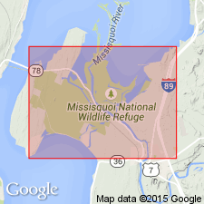
Type locality: in belt of outcrop between Cornwall village and The Ledges, Addison Co., [Cornwall 7.5-min quadrangle], central western VT. Named from stream that enters Lemon Fair River, 3 mi west of type locality.
Source: US geologic names lexicon (USGS Bull. 1200, p. 535).

- Usage in publication:
-
- Burchards limestone
- Modifications:
-
- Areal extent
- AAPG geologic province:
-
- New England province
Summary:
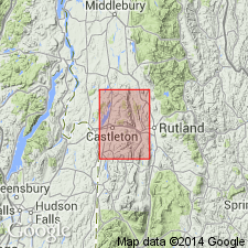
Pg. 13 (table 1), 28-29, pls. 1, 2 (corr. chart, geol. map). Burchards limestone of Chazy group. Dark-gray and white finely banded marble with few thin brown-weathering dolomite beds. Thickness about 75 feet at surface, but base not exposed; elsewhere thickness is about 150 feet. Questionably overlies Bascom formation disconformably. Only surface exposure is on eastern edge of West Rutland athletic field (Castleton 15-min quadrangle, Rutland County, west-central Vermont). Bain (Amer. Jour. Sci., 5th ser., v. 22, p. 503-530, 1931; Econ. Geol., v. 29, p. 121-139, 1934) included these rocks in his West Blue marble [informal]. Fossils; carries gastropod MACLURITES MAGNUS (Le Sueur). Age is early Middle Ordovician (Crown Point provincial stage).
Source: Publication; US geologic names lexicon (USGS Bull. 1200, p. 535).

- Usage in publication:
-
- Burchards Limestone Member
- Modifications:
-
- Revised
- AAPG geologic province:
-
- New England province
Summary:
Burchards Limestone Member is here assigned to the Providence Island Formation rather than the Chipman Formation. Use of the name Providence Island has precedence and is in keeping with the current New York terminology.
Source: GNU records (USGS DDS-6; Reston GNULEX).
For more information, please contact Nancy Stamm, Geologic Names Committee Secretary.
Asterisk (*) indicates published by U.S. Geological Survey authors.
"No current usage" (†) implies that a name has been abandoned or has fallen into disuse. Former usage and, if known, replacement name given in parentheses ( ).
Slash (/) indicates name conflicts with nomenclatural guidelines (CSN, 1933; ACSN, 1961, 1970; NACSN, 1983, 2005, 2021). May be explained within brackets ([ ]).

