- Usage in publication:
-
- Bunker Hill Formation
- Modifications:
-
- Named
- Dominant lithology:
-
- Arkose
- Gneiss
- Slate
- AAPG geologic province:
-
- Piedmont-Blue Ridge province
Summary:
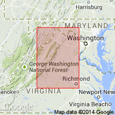
Named as a basal formation in Lynchburg Group. Previously mapped as Loudoun Formation by Keith (19894). Named for old settlement of Bunker Hill, along VA Hwy 55 between Marshall and The Plains, Fauquier Co., northern VA. Its massive arkose beds form ridges. Excellent outcrops also near Zulla and west of Halfway along Goose Creek near Fox Croft school in Loudoun Co. Composed of coarse- to medium-grained biotite arkose or arkosic biotite gneiss, interlayered with gray slates. Conglomerates near or at base are reported locally where they are considered the equivalent of Rockfish Conglomerate. Lower beds contain clasts resembling Marshall Granite. Northeast of Lynchburg, south of Southern Railway, a good section of Lynchburg Group is overlain to the east by Catoctin Greenstone. Bunker Hill overlies Lovingston Gneiss and is well exposed south of Amherst, Tye River, and Naked Mountains. This was previously mapped by author (Furcron, 1939) as Loudoun Formation; however, it corresponds to rocks mistakenly mapped as Loudoun by Keith (1894) of Loudoun Co., and is not Cambrian. Age is late Precambrian.
Source: GNU records (USGS DDS-6; Reston GNULEX).

- Usage in publication:
-
- Bunker Hill Formation
- Modifications:
-
- Age modified
- Overview
- AAPG geologic province:
-
- Piedmont-Blue Ridge province
Summary:
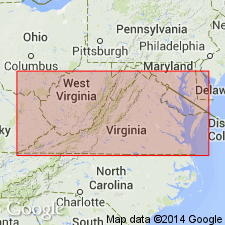
Bunker Hill Formation is partially equivalent to rocks previously called Loudoun Formation by Furcron (1969) in Warrenton 7.5-min quad and to meta-arkose described by Espenshade and Clarke (1976). In Culpeper area, Bunker Hill is basal member of Lynchburg Group. To the south, occurs only as thin, isolated lenses; disappears completely in Rockfish River area. Thickness ranges from 0 to 1000 m in Culpeper area. Consists of light-gray, poorly sorted, medium-grained to granule feldspathic arenite with minor pale-green siltstone and mudstone. Distinguished from other coarse-grained sandstones of Lynchburg by its abundant large-scale cross stratification and arenitic texture. Age is Late Proterozoic.
Source: GNU records (USGS DDS-6; Reston GNULEX).
- Usage in publication:
-
- Bunker Hill Formation*
- Modifications:
-
- Revised
- AAPG geologic province:
-
- Piedmont-Blue Ridge province
Kasselas, G.D., 1993, Stratigraphic framework, structural evolution and tectonic implications of the eastern Blue Ridge sequence in the central Appalachians near Warrenton, Virginia: Virginia Polytechnic Institute and State University, Department of Geological Sciences M.S. thesis, __ p.
Summary:
Bunker Hill Formation was mapped by Wehr (1985) as part of Lynchburg Group in Culpeper, VA, area. In this report, Bunker Hill is extended northward to the Warrenton area in same stratigraphic position, and is basal unit of both Lynchburg Group and Fauquier Group (rank raised). Assigned to Fauquier Group north of Carter Run fault. Thickness ranges from 1000 to 2600 m. Nonconformably overlies Marshall Metagranite; upper contact is transitional to Monumental Mills Formation (also here reassigned to Fauquier Group north of Carter Run fault). Divided into five major facies: feldspathic arenite, rare quartz arenite, and granule conglomerate; feldspathic wacke; granule conglomerate; sandstone and siltstone;, and mudstone. Report includes geologic maps, correlation charts, and measured sections.
Source: GNU records (USGS DDS-6; Reston GNULEX).

- Usage in publication:
-
- Bunker Hill Formation*
- Modifications:
-
- Revised
- AAPG geologic province:
-
- Piedmont-Blue Ridge province
Summary:
Bunker Hill Formation assigned to Fauquier Group (rank raised). Report includes geologic maps, correlation chart, and isotopic data.
Source: GNU records (USGS DDS-6; Reston GNULEX).
For more information, please contact Nancy Stamm, Geologic Names Committee Secretary.
Asterisk (*) indicates published by U.S. Geological Survey authors.
"No current usage" (†) implies that a name has been abandoned or has fallen into disuse. Former usage and, if known, replacement name given in parentheses ( ).
Slash (/) indicates name conflicts with nomenclatural guidelines (CSN, 1933; ACSN, 1961, 1970; NACSN, 1983, 2005, 2021). May be explained within brackets ([ ]).

