

- Usage in publication:
-
- Bullion dolomite member*
- Modifications:
-
- Named
- Dominant lithology:
-
- Dolomite
- AAPG geologic province:
-
- Great Basin province
Summary:
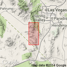
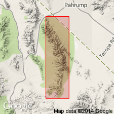
Named for exposures near Bullion mine, sec.23 T25S R58E, Goodsprings quad, Clark Co, NV-San Bernardino Co, CA. [no type designated] Included as third youngest member of Monte Cristo limestone (new). Occurs throughout quad. In south part consists of cream-colored and coarsely crystalline material; weathered surfaces are dark. North of Wilson Pass beds are light-gray to nearly white. Dolomite contains small irregular cavities. Chert is uncommon. Thickness varies from 185 to 300 ft. Underlies Arrowhead limestone member (new) and overlies Anchor limestone member (new) (both of Monte Cristo limestone). Contains few fossils of early Mississippian age. Is considered Early Mississippian age.
Source: GNU records (USGS DDS-6; Menlo GNULEX).
- Usage in publication:
-
- Bullion member
- Modifications:
-
- Areal extent
- Revised
- AAPG geologic province:
-
- Great Basin province
Summary:
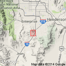
Mapped in Sloan district, NV, where Bullion member consists of light-gray, crystalline, pure, buff-weathering dolomite. Includes beds equivalent to Arrowhead limestone and Yellowpine limestone members in Goodsprings quad. Is 445 ft thick. Overlies Anchor member of Monte Cristo dolomite. Underlies Bird Spring formation. Stratigraphic section on Sloan Hill included. Is Mississippian age.
Source: GNU records (USGS DDS-6; Menlo GNULEX).
- Usage in publication:
-
- Bullion dolomite member*
- Modifications:
-
- Mapped
- AAPG geologic province:
-
- Great Basin province
Summary:
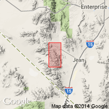
Is structurally and lithologically described with maps and cross sections near each of mines in Yellow Pine district, NV. Maps indicate Mississippian age.
Source: GNU records (USGS DDS-6; Menlo GNULEX).
- Usage in publication:
-
- Bullion limestone member
- Modifications:
-
- Areal extent
- AAPG geologic province:
-
- Great Basin province
Summary:
Geographically extended into Nopah Range, Inyo Co, CA, where unit is described as limestone 515 ft thick. Overlies Anchor limestone member; underlies Yellowpine limestone member (both of Monte Cristo limestone). (Arrowhead limestone member not recognized in this area.) Stratigraphic section shows Mississippian (Osagean) age.
Source: GNU records (USGS DDS-6; Menlo GNULEX).
- Usage in publication:
-
- Bullion dolomite member*
- Modifications:
-
- Areal extent
- AAPG geologic province:
-
- Great Basin province
Summary:
Bullion dolomite member of Monte Cristo limestone is recognized throughout north half of Ivanpah quad and is also present on Old Dad Mountain, San Bernardino Co, CA in southwest corner of quad. Is nearly pure dolomite throughout most of region. Fossils are uncommon. Age of Monte Cristo limestone [and thus its members] is considered Early Mississippian based on fossils identified by G.H. Girty in 1928.
Source: GNU records (USGS DDS-6; Menlo GNULEX).
- Usage in publication:
-
- Bullion Limestone
- Modifications:
-
- Revised
- AAPG geologic province:
-
- Great Basin province
Summary:
Bullion Dolomite Member (of Hewett, 1931) is raised in rank to Bullion Limestone of Monte Cristo Group. Characterized by massive cliffs of thick-bedded, fine- to medium-grained crinoidal, gray limestone which weathers light gray. Is 366.2 ft thick at Hidden Valley, 509.7 ft thick at Battleship Wash, and 425 ft at Bitter Spring Gap in Muddy Mountains. Since Arrowhead Limestone is not recognized in Arrow Canyon Range, top of Bullion Limestone is difficult to define and is placed at base of darker gray-weathering limestone, Yellowpine Limestone. Composite columnar section shows Mississippian age.
Source: GNU records (USGS DDS-6; Menlo GNULEX).
- Usage in publication:
-
- Bullion Member*
- Modifications:
-
- Areal extent
- AAPG geologic province:
-
- Plateau sedimentary province
Summary:
Extended into northwest Mohave Co, AZ, Plateau sedimentary province. [Extended from Muddy and northern Black Mountains, Clark Co, NV]. Is third from base of five members of Monte Cristo Limestone. Individual members were not separately mapped. Conformably overlies Anchor Member of Monte Cristo; conformably underlies Arrowhead Member of Monte Cristo. Age of unit not specified; age of Monte Cristo is Early and Late Mississippian.
Source: GNU records (USGS DDS-6; Denver GNULEX).
For more information, please contact Nancy Stamm, Geologic Names Committee Secretary.
Asterisk (*) indicates published by U.S. Geological Survey authors.
"No current usage" (†) implies that a name has been abandoned or has fallen into disuse. Former usage and, if known, replacement name given in parentheses ( ).
Slash (/) indicates name conflicts with nomenclatural guidelines (CSN, 1933; ACSN, 1961, 1970; NACSN, 1983, 2005, 2021). May be explained within brackets ([ ]).