The National Geologic Map Database is migrating to a new infrastructure. We apologize for any service disruptions during this process.
|
|---|


- Usage in publication:
-
- Bullion Creek Formation
- Modifications:
-
- Original reference
- Dominant lithology:
-
- Clay
- Silt
- Sand
- Lignite
- AAPG geologic province:
-
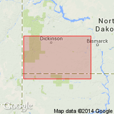
- Williston basin
Summary:
Pg. 10-12. Bullion Creek Formation of Fort Union Group. Alternating beds of clay, silt, sand, and lignite. Formation has a light yellow hue; where lignite beds have burned, overlying sediment has been baked, producing bright red colors. At type section includes lignite (informal Meyer bed) near top. Thickness 300+ feet (approximately 100 m) at type section; ranges from about [160 to 650 feet], 50 to 200 m. Conformably underlies Sentinel Butte Formation of Fort Union Group. Overlies white marker zone of Slope Formation (new) of Fort Union Group with apparent unconformity. [Equivalent to part or all of the Tongue River of previous workers (definitions varied).] Recognized in North Dakota, Montana, and South Dakota. Age is considered Paleocene, [based on stratigraphic position], cites R.W. Brown, 1962 (USGS Prof. Paper 374, Paleocene flora of Rocky Mountains and Great Plains).
Type section: Red Hills section of J.W. Crawford, 1967 (Univ. North Dakota MS thesis), in SW/4 sec. 27, SE/4 sec. 28, NE/4 sec. 33, and NW/4 sec. 34, T. 137 N., R. 103 W., [approx. Lat. 46 deg. 38 min. 38 sec. N., Long. 103 deg. 40 min. 19 sec. W., Dry Bullion Creek 7.5-min quadrangle, Little Missouri National Grassland], Golden Valley Co., southwestern ND.
Type area: within 15 km radius of Bullion Butte [located along Billings-Golden Valley Co. line, in sec. 18, T. 137 N., R. 102 W., Bullion Butte 7.5-min quadrangle, southwestern ND].
Named from Bullion Creek, 5 km north of type section, [Dry Bullion Creek 7.5-min quadrangle, Golden Valley Co., Little Missouri National Grassland, southwestern ND].
[Additional locality information from USGS historical topographic map collection TopoView, accessed September 1, 2016.]
Source: Publication; US geologic names lexicon (USGS Bull. 1564, p. 23).
For more information, please contact Nancy Stamm, Geologic Names Committee Secretary.
Asterisk (*) indicates published by U.S. Geological Survey authors.
"No current usage" (†) implies that a name has been abandoned or has fallen into disuse. Former usage and, if known, replacement name given in parentheses ( ).
Slash (/) indicates name conflicts with nomenclatural guidelines (CSN, 1933; ACSN, 1961, 1970; NACSN, 1983, 2005, 2021). May be explained within brackets ([ ]).