The National Geologic Map Database is migrating to a new infrastructure. We apologize for any service disruptions during this process.
|
|---|


- Usage in publication:
-
- Bull Lake stage*
- Modifications:
-
- Named
- Dominant lithology:
-
- Till
- AAPG geologic province:
-
- Yellowstone province
Summary:
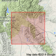
Is middle of three glacial stages (Buffalo, Bull Lake, and Pinedale stages) recognized based on study of deposits of more than forty-five Pleistocene glaciers distributed over large part of western WY. Deposits of the Bull Lake stage (Bull Lake drift) named from Bull Lake on the north slope of the Wind River Range, Ts2 and 3N, Rs2 and 3W, Fremont Co., WY (Wind River basin). Type locality not designated. Terminal and lateral moraines are preserved largely intact. Bull Lake drift considered older than Pinedale drift because: "(a) boulders are by no means as abundant upon the surface as they are on the Pinedale moraines, and those which remain show plainly the effects of weathering; (b) lakes are rare or absent, but hollows filled with peat mark the sites of many that have disappeared; (c) the principal creeks have cut not merely sharp ravines but rather wide flat-bottomed valleys through the terminal moraines, and the tributaries have largely dissected the lateral moraines into short pieces." Sketch maps (figs. 43, 44) show dissection. Glaciers of the Bull Lake and Pinedale stages were valley glaciers, while the Buffalo stage produced a much larger piedmont glacier. The nature of the deposits suggests that "the period between the Buffalo and the Bull Lake glacial stages was several times as long as the next succeeding interglacial interval, and many times longer than the post-glacial epoch." Summary scheme (table II, p. 310) of glacial stages and erosion cycles, shows Bull Lake stage occurred between Circle (older) and Lenore (younger) erosion cycles.
Source: GNU records (USGS DDS-6; Denver GNULEX).
- Usage in publication:
-
- Bull Lake glaciation*
- Modifications:
-
- Areal extent
- AAPG geologic province:
-
- San Luis basin
- Estancia basin
Summary:
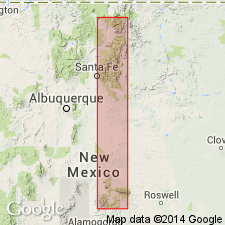
Commonly consists of two broad, nature moraines assigned to the early and late stades in canyons dissected by axial and tributary streams; they have mature zonal soils 3 to 4 ft thick. Two tills grade into separate outwash deposits which where superposed, are separated and overlain by mature zonal soils similar to those on moraine deposits. These characteristics of the glaciation in the Wind River Mountains of WY can be recognized at 3 localities in central NM. The early stade lies at 9,400 ft at Wheeler Peak, Taos Co., in the San Luis basin, at 10,000 ft at Lake Peak, Rio Nambe, Santa Fe Co. in the Estancia basin, and at 9,850 ft at Sierra Blanca Peak, Santa Fe Co. in the Estancia basin. The late stade lies at 9,700 ft at Wheeler Peak, at 10,500 ft at Lake Peak, and at 10,400 ft at Sierra Blanca Peak. Small maps delineate occurrence in each area. Correlation chart. Of early late Pleistocene age.
Source: GNU records (USGS DDS-6; Denver GNULEX).
- Usage in publication:
-
- Bull Lake Till*
- Modifications:
-
- Contact revised
- AAPG geologic province:
-
- Wind River basin
Summary:
Divisible into 2 sets of moraines and associated outwash terraces. Described in 2 measured sections in Fremont Co., WY, Wind River basin. In section on Cedar Ridge, sec. 31, T3N, R3W, the Bull Lake is a 30 to 40 ft thick brown compact, stony, silty, bouldery sand disconformably beneath the Pinedale Till. In section on Sacagawea Ridge, sec. 31, T5N, R5W, the Bull Lake is 16 to 42 ft thick of brown, compact, friable silty sand and unsorted subangular to angular pebbles and boulders -mostly limestone, some crystalline rocks. Lower contact revised in that Bull Lake disconformably overlies the newly named Dinwoody Lake Till; Dinwoody Lake deposits of this report were mapped as part of Buffalo Till in earlier reports. Name Buffalo not used. Of Pleistocene age.
Source: GNU records (USGS DDS-6; Denver GNULEX).
- Usage in publication:
-
- Bull Lake glaciation*
- Modifications:
-
- Geochronologic dating
- Age modified
- AAPG geologic province:
-
- Montana folded belt
Summary:
Moraines of West Yellowstone are correlated with type Bull Lake and Pinedale (200 km southeast of West Yellowstone) on basis of relative morphologic expression, soil development, basalt weathering rinds, loess mantle, degree of breaching by streams, and geologic sequence. Near West Yellowstone, Bull Lake moraines are older than West Yellowstone rhyolite flow, and Pinedale moraines are younger than the flow. Best estimate of age of West Yellowstone flow based on weighted average of K-Ar ages on sanidine and glass from two samples is 114,500 +/-7300 yr. Obsidian hydration rinds on glacially abraded obsidian from Bull Lake and Pinedale moraines indicate an age of about 140,000 and 30,000 yr, respectively. Previous age estimates of Bull Lake and Pinedale glaciations are significantly younger than the ages determined in this study. Bull Lake moraines correlate with younger part of Illinoian glaciation rather than with early Wisconsin glaciation and Pinedale glaciation correlates with much or all of Wisconsin glaciation rather than with late Wisconsin as commonly believed. This work also finds no basis for subdividing Bull Lake into "early" and "late" stade; end moraines are only of one general age in West Yellowstone area.
Source: GNU records (USGS DDS-6; Denver GNULEX).
- Usage in publication:
-
- Bull Lake Till*
- Modifications:
-
- Principal reference
- Dominant lithology:
-
- Till
- AAPG geologic province:
-
- Wind River basin
Summary:
Holostratotype area [type area] designated as "Three end moraines beyond those of the late Wisconsin Pinedale glaciation north of Bull Lake in the Crowheart Butte and Bull Lake East quadrangles, Fremont County" WY, Wind River basin. Lectostratotype [principal reference] designated at escarpment of Cedar Ridge, on north side of Bull Lake in SE/4 SE/4 sec 29, T3N, R3W, Bull Lake West quad, Fremont Co, WY, Wind River basin. Lectostratotype section described. [Section also described in Richmond, 1964, USGS Prof. Paper 501-D, p. D104-109.] Consists of lower (84 ft thick) and upper (46 ft thick) tills disconformably separated by intra-Bull Lake soil (3.8 ft thick). Lower till is composed of light-brown to light-yellowish-brown compact massive stony silty sand; very bouldery; matrix has distinctive pinkish hue owing to silt derived from Mesozoic red beds. Upper till is composed of light-brown, locally light olive brown, compact friable silty sand and unsorted, unsized subangular to angular pebbles to boulders. Lower till disconformably overlies soil; upper till underlies post-Bull Lake soil. Tills correlated with Bull Lake occur throughout the Rocky Mountain region. Assigned early Wisconsinan age.
Source: GNU records (USGS DDS-6; Denver GNULEX).
For more information, please contact Nancy Stamm, Geologic Names Committee Secretary.
Asterisk (*) indicates published by U.S. Geological Survey authors.
"No current usage" (†) implies that a name has been abandoned or has fallen into disuse. Former usage and, if known, replacement name given in parentheses ( ).
Slash (/) indicates name conflicts with nomenclatural guidelines (CSN, 1933; ACSN, 1961, 1970; NACSN, 1983, 2005, 2021). May be explained within brackets ([ ]).