

- Usage in publication:
-
- Bug Formation*
- Modifications:
-
- Named
- Dominant lithology:
-
- Limestone
- Siltstone
- Claystone
- Sandstone
- Conglomerate
- AAPG geologic province:
-
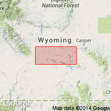
- Wind River basin
Summary:
Named for Bug Ranch headquarters, Beulah Belle Lake quad about 2 mi northeast of type section in SW1/4 SE1/4 sec 5, T30N, R87W in Miller Spring quad, Natrona Co., WY in Wind River basin. Known only in type section an area of about 3 sq mi. Is a light green to white limestone that may be partly porous, partly dense, clayey, fine grained interbedded with greenish-gray claystone, and gray thin-bedded siltstone and brown to tan medium to coarse-grained sandstone and dark gray conglomerate. Is 118+ ft thick at type where it overlies Split Rock Formation with erosional and probably angular unconformity. Probably does not exceed 125 ft in thickness. Is similar to Moonstone Formation in general rock types, but conglomerates in Bug are chiefly andesite (Moonstone derived chiefly from Precambrian). Is thin bedded (Moonstone is not). Has claystone but shale is rare (Moonstone has conspicuous shale). Many beds in Moonstone are radioactive (only limestone is radioactive in Bug). Has abundant agate and chalcedony beds formed in place (Bug has only agate pebbles). Age based entirely on diatoms (not older than Pliocene and more likely Pleistocene). Assigned to Pliocene or Pleistocene.
Source: GNU records (USGS DDS-6; Denver GNULEX).
For more information, please contact Nancy Stamm, Geologic Names Committee Secretary.
Asterisk (*) indicates published by U.S. Geological Survey authors.
"No current usage" (†) implies that a name has been abandoned or has fallen into disuse. Former usage and, if known, replacement name given in parentheses ( ).
Slash (/) indicates name conflicts with nomenclatural guidelines (CSN, 1933; ACSN, 1961, 1970; NACSN, 1983, 2005, 2021). May be explained within brackets ([ ]).