The National Geologic Map Database is migrating to a new infrastructure. We apologize for any service disruptions during this process.
|
|---|


- Usage in publication:
-
- Buena Vista quarries
- Buena Vista stone
- Modifications:
-
- Original reference
- Dominant lithology:
-
- Sandstone
- AAPG geologic province:
-
- Appalachian basin
Summary:
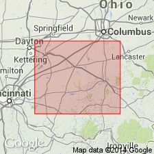
Pg. 615, 618, 626. Buena Vista quarries (also Buena Vista stone). Series of quarry sandstones 10 feet thick, separated from underlying Waverly black slate by 35 to 50 feet of blue shales in Ross and Pike Counties, Ohio. Have been called Waverly brownstone. [Age is Mississippian.]
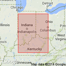
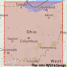
Named from Buena Vista, Scioto Co., southern OH.
Source: US geologic names lexicon (USGS Bull. 896, p. 286).
- Usage in publication:
-
- Buena Vista member
- Modifications:
-
- Revised
- Dominant lithology:
-
- Sandstone
- Shale
- AAPG geologic province:
-
- Appalachian basin
Summary:
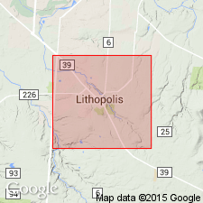
Pg. 336-343. Buena Vista member of Cuyahoga formation as here redefined consists, at Lithopolis, Fairfield County, central Ohio, of 49+ feet of alternating sandstones and shales, including 5 feet above the base, the "City Ledge," 2 feet 10 inches thick, and 45+/- feet of beds above the "City Ledge." Overlies Sunbury shale. By some Buena Vista has been restricted to "City Ledge." I erroneously so used it in 1902. [Age is Mississippian.]
Source: US geologic names lexicon (USGS Bull. 896, p. 286).
- Usage in publication:
-
- Buena Vista member
- Modifications:
-
- Revised[?]
- Dominant lithology:
-
- Sandstone
- AAPG geologic province:
-
- Appalachian basin
Summary:
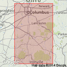
Pg. 761. Buena Vista member of Cuyahoga formation is restricted [?] to "City Ledge." It consists of 1 to 30 feet of sandstones underlying Rarden shale member and overlying Henley shale member (5.5 to 226 feet thick). Age is Mississippian.
[This is present (ca. 1936) approved definition (USGS).]
Source: US geologic names lexicon (USGS Bull. 896, p. 286).
- Usage in publication:
-
- Buena Vista sandstones
- Modifications:
-
- Revised
- AAPG geologic province:
-
- Appalachian basin (Eastern Overthrust area)
Summary:
Pg. 358. Divided Cuyahoga into (descending) Black Hand conglomerate, Raccoon shale, and Buena Vista sandstones, the latter overlying Sunbury shale. [Age is Mississippian.]
Source: US geologic names lexicon (USGS Bull. 896, p. 286).
- Usage in publication:
-
- Buena Vista siltstone member
- Modifications:
-
- Revised
- Dominant lithology:
-
- Siltstone
- AAPG geologic province:
-
- Appalachian basin
Summary:
Pg. 77, 78, 133, pl. 6. Buena Vista siltstone considered member of New Providence formation in area of Vanceburg facies (in vicinity of Vanceburg, Lewis County, northern Kentucky). Overlies Henley member; underlies Rarden member; [Stockdale] cannot clearly justify Hyde's recognition of the Buena Vista in Lewis County; this is partly because of difficulty in distinguishing overlying "Rarden shale member" of Hyde in Kentucky. Age is considered Early Mississippian [Osage].
Source: US geologic names lexicon (USGS Bull. 1200, p. 519, Vanceburg entry p. 4053).

- Usage in publication:
-
- Buena Vista sandstone member
- Modifications:
-
- Revised
- AAPG geologic province:
-
- Appalachian basin
Summary:
Pg. 173; Jour. Geol., v. 50, no. 1, p. 41 (table 2), 60-61, 62. Buena Vista sandstone considered basal member of Logan formation. In area of Vanceburg facies, underlies Rarden shale member; in area of Scioto Valley facies, underlies Portsmouth shale member. [Age is Mississippian.]
[Area in Scioto County, southern Ohio, and Lewis County, northern Kentucky.]
Source: US geologic names lexicon (USGS Bull. 1200, p. 519).
- Usage in publication:
-
- Buena Vista sandstone member
- Modifications:
-
- Areal extent
- AAPG geologic province:
-
- Appalachian basin
Summary:
Pg. 3 (table 1), 24, 25. Buena Vista sandstone member of Cuyahoga formation. Here considered member of Cuyahoga in areas of Scioto Valley and Vanceburg facies where it overlies Henley shale member; in Scioto Valley facies, underlies Portsmouth shale member; in Vanceburg facies, underlies Rarden shale member. [Age is Mississippian.]
[Area in Scioto County, southern Ohio, and Lewis County, northern Kentucky.]
Editor's note states that Hyde (1921, Ohio Geol. Survey Bull., no. 23) correlated Buena Vista sandstone with Berne and lower part of Byer in discussion geology of Camp Sherman quadrangle; such a correlation would necessitate placing Rarden, Vanceburg, Churn Creek, and most of Portsmouth shale in Logan formation.
Source: US geologic names lexicon (USGS Bull. 1200, p. 519).
For more information, please contact Nancy Stamm, Geologic Names Committee Secretary.
Asterisk (*) indicates published by U.S. Geological Survey authors.
"No current usage" (†) implies that a name has been abandoned or has fallen into disuse. Former usage and, if known, replacement name given in parentheses ( ).
Slash (/) indicates name conflicts with nomenclatural guidelines (CSN, 1933; ACSN, 1961, 1970; NACSN, 1983, 2005, 2021). May be explained within brackets ([ ]).