The National Geologic Map Database is migrating to a new infrastructure. We apologize for any service disruptions during this process.
|
|---|


- Usage in publication:
-
- Buckskin Formation
- Modifications:
-
- Named
- Dominant lithology:
-
- Sandstone
- Siltstone
- Phyllite
- Schist
- Quartzite
- AAPG geologic province:
-
- Plateau sedimentary province
Summary:
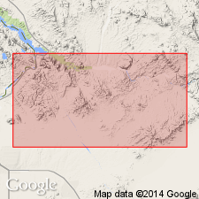
Named for exposures in Mineral Hill area of Buckskin Mountains. Type section is 400 m west and southwest of Planet Mine and trends SSW from center of SW1/4 SW1/4 sec 31, T11N, R16W to center of NE1/4 sec 1, T10N, R17W, Mohave Co, AZ, Plateau sedimentary province. Faulted at its base and unconformably overlain by Vampire Formation (new) at its type and in a partial measured section of middle part of Buckskin in center of sec 10, T10N, R17W. Depositional base present in western Buckskin Mountains where it rests on Kaibab Formation. Considered to be equivalent to Moenkopi Formation on basis of lithology and stratigraphic position. Consists of quartzofeldspathic to quartzose, locally calcareous sandstone and siltstone, phyllite, conglomerate, and gypsiferous rocks. In Mineral Hill and south of Rio Vista areas, four members (ascending): 1) lower 400 m thick, a quartzose to quartzofeldspathic sandstone and siltstone, metapelite, and phyllite, chloritic schist, and quartzite and carbonate pebble conglomerate; 2) quartzite member 2-15 m thick, massive to poorly bedded, fine to very fine grained gray to brown; 3) phyllite member, 30-60 m thick phyllite, slate, phyllitic siltstone, micaceous sandstone, conglomerate, gypsiferous rocks; 4) upper member 40-400 m thick, massive to poorly bedded, fine- to medium-grained, moderately to well-sorted quartzite and quartzose sandstone. Geologic maps. Triassic age.
Source: GNU records (USGS DDS-6; Denver GNULEX).
For more information, please contact Nancy Stamm, Geologic Names Committee Secretary.
Asterisk (*) indicates published by U.S. Geological Survey authors.
"No current usage" (†) implies that a name has been abandoned or has fallen into disuse. Former usage and, if known, replacement name given in parentheses ( ).
Slash (/) indicates name conflicts with nomenclatural guidelines (CSN, 1933; ACSN, 1961, 1970; NACSN, 1983, 2005, 2021). May be explained within brackets ([ ]).