

- Usage in publication:
-
- Buckskin Breccia*
- Modifications:
-
- Named
- Dominant lithology:
-
- Breccia
- Sandstone
- AAPG geologic province:
-
- Great Basin province
Summary:
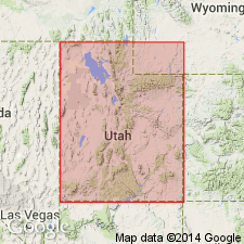
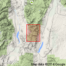
Named for Buckskin Valley 8 mi west of type section immediately north of UT State Hwy 20 about 10 km west of junction with U.S. Hwy 89, east of Bear Valley, SW1/4 NE1/4 sec 26, T32S, R6W, Iron Co, UT, Great Basin province. Mapped in earlier reports as part of Leach Canyon Formation. Overlies Isom Formation in its type section on Markagunt Plateau. Tongues into Mount Dutton Formation on southern Sevier Plateau. Consists light-colored stratified breccia with ubiquitous clasts of holocrystalline igneous rock identical to Spry intrusion. Three [breccia] beds totaling 30 m thick separated from each other by few m of tuffaceous sandstone; different in color, number of lithic fragments contained, and erosion; alike in containing clasts of similar lithology in fine-grained matrix of fragmented phenocrysts 0.25 to 2 mm diameter of plagioclase, potash feldspar, hornblende, biotite, augite, magnetite, minor accessory minerals, and in some places glass shards. Igneous activity produced autoclastic flow breccia or ash-flow tuff. Some rocks mudflow breccia. Exposed principally in area about 600 sq km on northern Markagunt Plateau where thickness 8-17 cm. Different thickness may be due to post-Isom block faulting. Other Buckskin exposures scattered on southwest and south-central Sevier Plateau. Underlies Bear Valley Formation. Probably early Miocene age based on stratigraphic position. Correlation chart; block diagram; measured sections.
Source: GNU records (USGS DDS-6; Denver GNULEX).
- Usage in publication:
-
- Buckskin Breccia*
- Modifications:
-
- Age modified
- AAPG geologic province:
-
- Great Basin province
Summary:
Buckskin Breccia occurs as a discontinuous lens in Marysvale SE quad and appears to include rocks older than those to the south. Age given as Oligocene and Miocene.
Source: GNU records (USGS DDS-6; Menlo GNULEX).
- Usage in publication:
-
- Buckskin Breccia*
- Modifications:
-
- Age modified
- AAPG geologic province:
-
- Great Basin province
Summary:
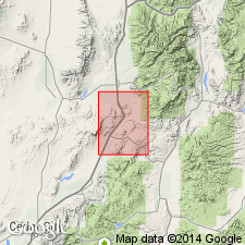
Age modified from Oligocene and Miocene to Oligocene on basis of interfingering relationships with Oligocene Isom Formation. Mapped in southeast corner of map area in Iron Co, UT in the Great Basin province.
Source: GNU records (USGS DDS-6; Denver GNULEX).
For more information, please contact Nancy Stamm, Geologic Names Committee Secretary.
Asterisk (*) indicates published by U.S. Geological Survey authors.
"No current usage" (†) implies that a name has been abandoned or has fallen into disuse. Former usage and, if known, replacement name given in parentheses ( ).
Slash (/) indicates name conflicts with nomenclatural guidelines (CSN, 1933; ACSN, 1961, 1970; NACSN, 1983, 2005, 2021). May be explained within brackets ([ ]).